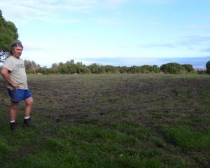
Technology and hard clues are used in a major search for a missing person, North Otago reporter Andrew Ashton discovered this week in the Ahuriri Valley.
"No stone unturned, no clue too small" is the motto driving the search for Dunedin man David Palmer, missing in the remote Dingle Burn area of inland Otago for almost a week.
An array of computers communicating via satellite; flip charts listing a host of clues; a character profile of Mr Palmer; and a boot imprint lifted from his abandoned car crowding out the control room walls at the search and rescue operation centre could be termed "high-tech".
But for the police and land search and rescue team members striving to locate the missing tramper, they provide clues much more along the lines of those in a Sherlock Holmes case than in CSI.
As a result, the sheer attention to detail that goes into analysing information has to be seen to believed.
So far, over the past five days of the Ahuriri Valley Conservation Park rescue operation, LandSAR volunteers, working side by side with army and police search teams, have meticulously logged a vast number of of clues that could help find Mr Palmer.
Even the smallest details could be relevant and searchers have been investigating clues including signs of an old fire, discarded eggshells and a cider bottle, all found on the Dingle Burn Track where Mr Palmer had been tramping.
Unfortunately, those finds had all proven to be dead ends, but incident controller Senior Sergeant Brian Benn said recording all finds was in keeping with the operation's adopted motto.
"No stone unturned, no clue too small.
"We find a lot of clues - everything goes into the mix.
"As the days go by we start discarding them."
Every detail is recorded and logged, and that has helped searchers build up a fuller picture of the missing man's possible state of mind and plans.
Early initial searches, or "reflex tasking", carried out in the initial hours and days since Mr Palmer's disappearance, focused on the immediate location around his car and his planned walking route, but since then the search has broadened in scope.
"So it starts off with reflex tasking and then we go further in formal search planning. That lets us check more out to plan what he had planned, then we get a segment for the whole search area," Sgt Benn said.
Once smaller "segments" or areas of significant interest are identified, search teams are each assigned an area they are able to search in a single day. The size of the search areas depends on the type of terrain to be covered.
It was important to have clearly identified tasks to complete to ensure everything possible was being done, Sgt Benn said.
Rescuers conduct a three-pronged search, first covering the area on foot, after which the area is covered again by a dog team and a helicopter search.
Each team keeps meticulous records of where they have searched and what they found. Those records are then noted at the operations base, along with the exact route taken as recorded via GPS.
Because every search team member had a GPS locator, individual search routes could be collated to provide a precise picture of which areas had been searched and to what extent, Sgt Benn said.
"Each search is recorded as a quality-of-search measure. GPS tracks are downloaded that give a very accurate description of where they have actually been and any gaps in search fields would then be easily identifiable.
"Satellite communications are good and that has improved our ability to communicate and record the GPS tracks from the search teams. All LandSAR operations were conducted according to "tried and true international practices", Sgt Benn said.
Part and parcel of the job was the harsh conditions LandSAR volunteers had to endure, and in this search they had braved large numbers of sandflies, wind, rain, hail, sleet and some very uncomfortable nights in the wilderness.
"I personally have tremendous respect for LandSAR Volunteers. They drop everything at the drop of a hat and then put themselves into some pretty challenging circumstances," Sgt Benn said.
However, he was quick to point out local knowledge and help was also proving invaluable. The Omarama community had flocking to the Birchwood base to help in any way they could.
"There has been a lot of support from the locals in Omarama. People have been helping out in a number of ways. If I need lunch for 50 people, it's here at 1 o'clock, delivered by an Omarama cafe.
"People have even been turning up with a pack and boots and asking to help. In these types of country operations it is a really big help."