River cruise operator Laurence van der Eb said earlier in the month the Clutha River had very high river levels by Alexandra but a bottleneck called the "narrows" about 5km downstream towards Roxburgh temporarily kept the high water levels in Alexandra at bay, while at the same time flushing at Roxburgh Dam created a very low water level in the river.
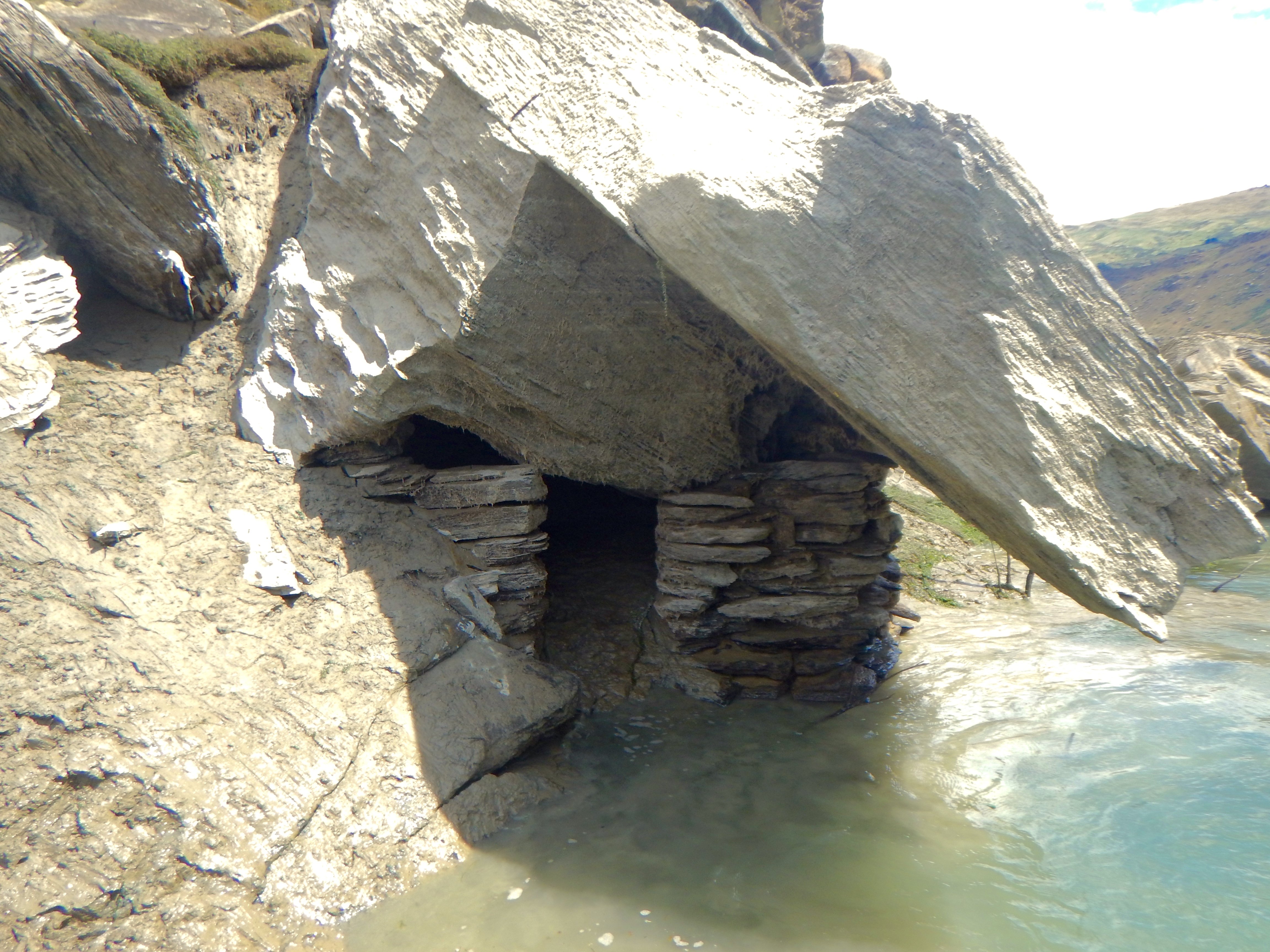
This revealed gold miners’ huts that had been submerged since the dam was filled.
The huts dated from the gold rush days of the 1860s.
It was a "rare event" to see the huts that were normally submerged, Mr van der Eb said.
Heritage New Zealand senior archaeologist Dr Matthew Schmidt said dozens of huts were known to be in the area and many more would lie underwater.
The gorge was never archaeologically recorded before the creation of Lake Roxburgh in the 1950s.
"Any information like this on how sites have survived beneath the water over the years is valuable."

"It was common to use natural caves all through the Clutha catchment, and not all of them were by the river."
The hut revealed was typical of a gold miner’s hut along the gorge, dating from the 1860s gold rush, and Depression-era miners in the 1930s often re-used the original huts, Dr Schmidt said.
Archaeologist Matthew Sole said an archaeological survey of the gorge in March 1980 recorded 79 rock shelters and 32 huts or cottages.
"The huts/shelter made use of schist from sluicing tailings incorporating schist bluffs, overhangs, caves from overlaid slabs from gorge rockfall," he said.
Roxburgh had many huts of this type and they also occurred in Cromwell Gorge and Kawarau Gorge "wherever large schist strata terrain exists".
The huts were along part of the Roxburgh Gorge Trail that was accessible by boat.
Mr van der Eb advised people to check with the Central Otago District Council before visiting the area as rain and high water events had affected some parts of the trail.