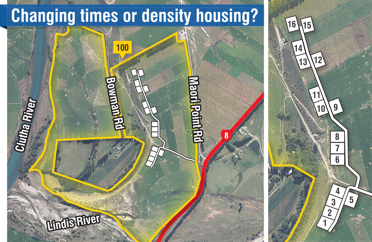
Clutha Plains Trust was seeking resource consent from the Central Otago District Council for a "farm park" style subdivision, comprising 16 residential sized lots and one productive lot at Māori Point Rd in Tarras.
Lots 1-16 will each have an area of 2000sq m and will be developed for rural residential purposes. Lot 100 is the balance lot and will be retained for productive farm use.
There were 18 submissions, 12 in support, one neutral and five against.
The land is situated in an area near Tarras, bordered by both the Lindis and Clutha Rivers.
At the council hearing, Clutha Plains Trust trustee Jonny Trevathan said the Central Otago area in the last 15 to 20 years had experienced notable shifts in land use.
This was due to the expansion of irrigation facilitating growth in the viticulture and horticulture sectors.
The landscape now featured numerous pivots, extensive bird netting, frost fans, and associated infrastructure such as pump sheds.
There was also a growing demand for rural living opportunities from individuals seeking respite or escape from urban environments and former farmers wishing to downsize while remaining in a rural setting.
"Change is an inherent aspect of community development, and proactive preparedness is preferable to reactive responses," he said.
A proposed international airport in Tarras and the Santana Minerals gold mine showed the area continued to attract interest, "underscoring the need to balance productivity with the preservation of the region’s unique characteristics".
The planned subdivison would finance the moving of a transmission line.
This would lead to an ability to use pivot irrigation which he estimated would increase his dry matter production by up to 20% and would easily offset any lost production from the subdivision proposal.
Submitter Linda Hamilton said the proposed subdivision was manifestly out of character with Tarras as there were no similarly sized subdivisions in the area.
Trying to mitigate the negative impact of the development by concealing it with native plantings would not maintain or enhance the amenity value of the open landscape.
"The proposed development is essentially medium density housing situated either in a remote location or across the road from an international airport and under the flight path," she said in her submission.
If approved it would set a precedent. She wanted the access road to be sealed because of the increased traffic.
Submitter Billie Marsh said the development was not like any approved development in the area.
"The number of houses, their close proximity and prominence when viewed within the existing landscape is significant.
"The development does not uphold landscape, visual and rural amenity values.
"The flat topography does not provide any screening from public view."
Council consulting planner Kirstyn Royce recommended to the panel that consent be declined.
The proposal had not established it would provide for the maintenance and enhancement of amenity values or the maintenance and enhancement of the quality of the environment.
The configuration of the subdivision, the significantly reduced separation between dwellings, proximity to the terrace edge, potential for skyline breaches associated with future development and the reliance on screen planting to mitigate effects over time, all led to effects on rural character, landscape and amenity values which would be adverse and unable to be adequately mitigated, she said in her report.
The panel of Crs Neil Gillespie, Ian Cooney, Martin McPherson and Tracy Paterson reserved their decision.