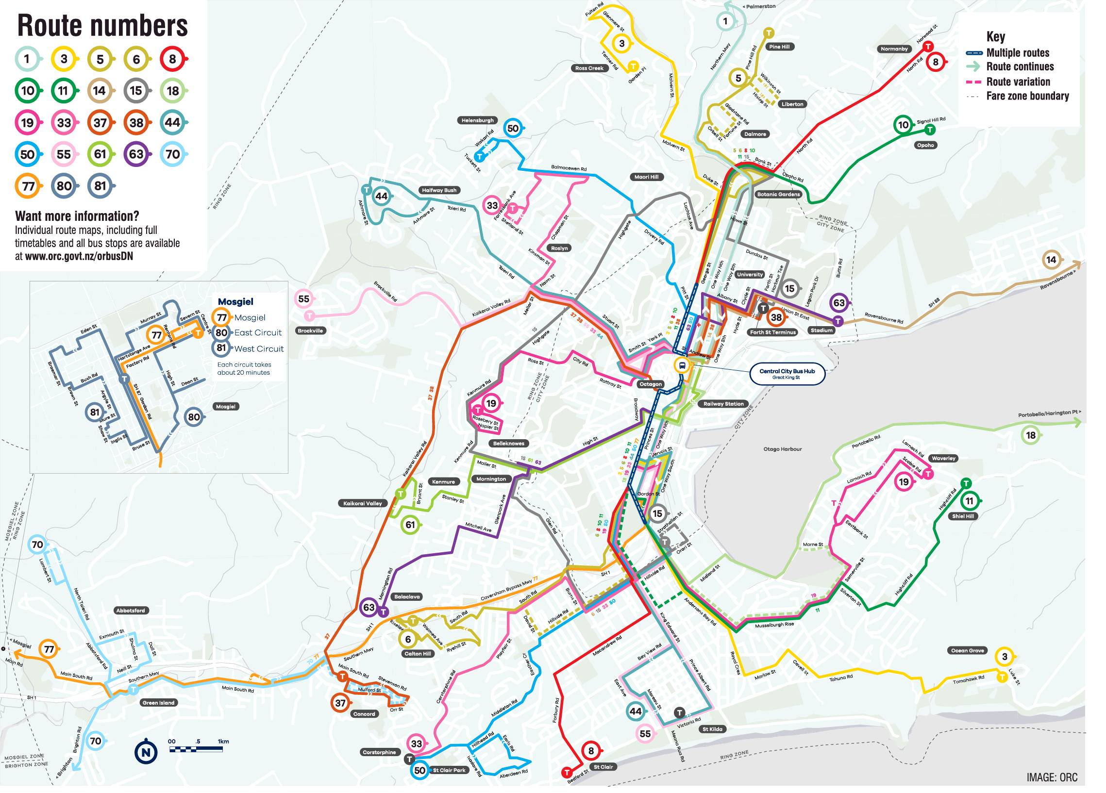
Dunedin's new bus map is an improvement, but still could be clearer in the central city, a local amateur cartographer says.
Last year University of Otago mathematics student Sam van der Weerden created a cleaner, minimalist version of Dunedin's ''messy'' bus map.
The Otago Regional Council acknowledged some work could be done in terms of clarity and released a new version of the map last week, to coincide with the city's bus hub announcement.
Staff said Mr van der Weerden was consulted about the design.
When contacted yesterday, Mr van der Weerden said he had one meeting with the council, but no further input.
Despite that, he thought the new map was ''certainly an improvement''.

''Once you look at the map outside of the Town Belt it's fantastic.''
However, the central city let the map down.
''The routes seem to go all over the show in the CBD, which is why in my one, I focused on a schematic view so I could enlarge the central area in more detail.''
It could be improved with thinner lines or a magnified central city on the map.
Clarity in maps was important in increasing the use of public transport, he said.
''If people perceive the system as too complex and hard to work out then they're more likely to not use it.
''But part of making a system more simple to use is the branding so it's great to see a cohesive brand for the system, and I'm sure the upcoming live tracking app will make things even better.''
A council spokesman said it was ''really pleased'' with the map and thought bus users would now find it much easier to see the whole network at a glance.


