And while the weather was pretty wet and miserable yesterday, MetService meteorologist Alec Holden said we could expect "plenty more scorchers" over the next month.
"It won’t be the last we see of these really hot temperatures."
Mr Holden said Saturday’s sweltering temperatures were caused by dry and hot foehn winds which preceded a front which moved up the South Island over the weekend.
"In addition, there was plenty of solar insulation going on with the sun beating down, so the combination of those two brought higher temperatures."
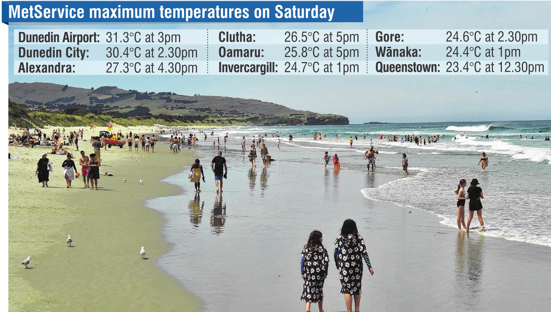
The temperature reached 31.3°C at Dunedin Airport, and 30.4°C in the city.
Although it was a scorcher, it was still nowhere near the January record which still stands at 35°C, set on January 16, 2018.
Mr Holden said a new front pushed up the country yesterday, bringing cooler temperatures and rain.
"That may have provided a little bit of light relief to those who didn’t enjoy that really hot weather."
He said that front would continue today, bringing "substantially" cooler temperatures, with places like Wanaka and Queenstown dipping as low as 5°C.
"They will get down to some winter temperatures overnight Monday, going into Tuesday.
"But on Tuesday, things will start to warm up again and we will see average summer temperatures in the 20s, return.
"There’s plenty more scorchers to come, but there’s nothing extreme on the horizon just yet."


