As the date approaches for the completion of Te Aka Ōtākou, Rudy Adrian goes for a ride.
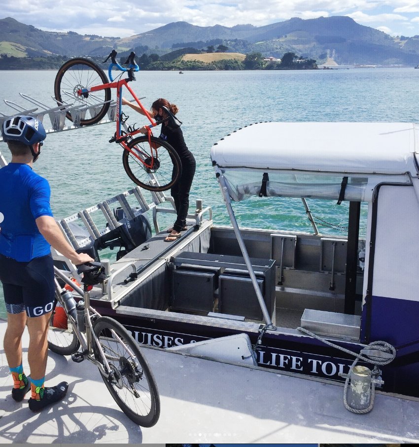
"Just hand me your bike and I’ll let you know if I need any help," says Port to Port Cruises and Wildlife Tours owner and operator Rachel McGregor, as about half a dozen of us load our bicycles on her boat at Port Chalmer’s Back Beach jetty.
It’s a sunny winter’s day and McGregor is providing the vital aqua-taxi link for my ride around some of Otago Harbour’s shared path cycle/walkway as it nears completion.
McGregor’s almost 9m-long MV Sootychaser operates as a harbour ferry and also offers wildlife cruises in the outer harbour.
"My first love is being on a boat and now I have a reason to take people somewhere to see the wildlife I’m passionate about," she explains.
Her venture started off with just a small rack on the back of the boat, able to take only a few bikes across the harbour at a time. This upgraded to a larger rack, expanding capacity to more than a dozen bikes.
McGregor hadn’t expected ferrying cyclists to become a core element of her enterprise.
"I thought the wildlife cruises were going to be the money-maker, but as the cycleway has been built, people have been coming along with their bikes. Now, I think it’ll become a main part of the business."

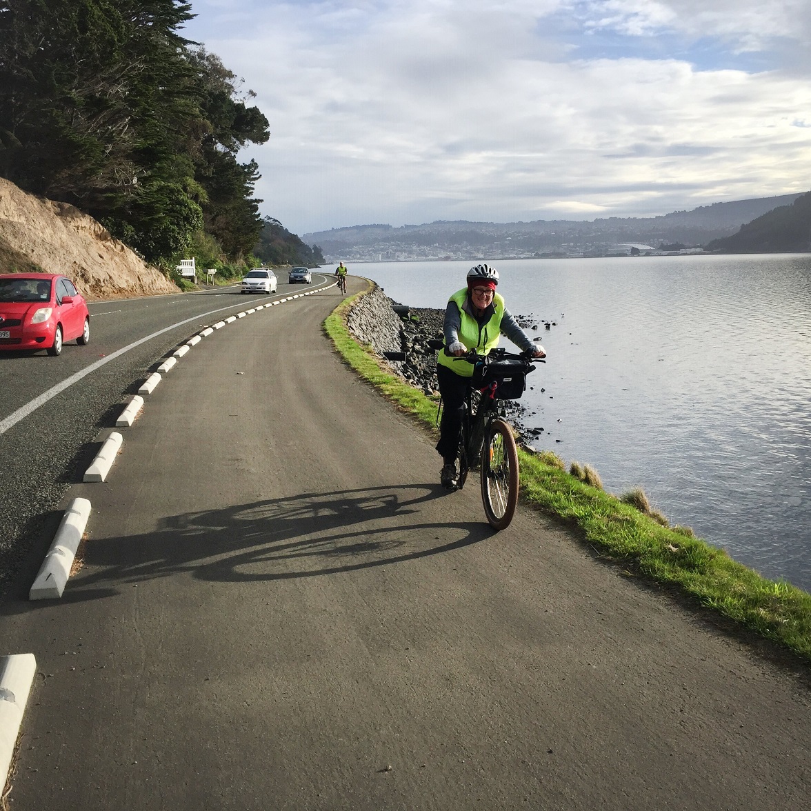
Stretching in an arc from Portobello to Port Chalmers, the initiative will see cyclists and walkers able to travel along the water’s edge, free for the most part, from worrying about cars and heavy trucks thundering past.
I’ve chosen the 15-minute ferry ride across the harbour as the first leg of my journey, light easterly winds forecast to push me along the peninsula’s coast road to Dunedin city - the section of the trail called Te Awa Ōtākou (The Ōtākou River) - then having the option to either cycle or catch a bus back to my car at Port Chalmers. The West Harbour side is called Te Ara Moana (The Ocean Path).
Disembarking from the MV Sootychaser on the peninsula side, I take a few minutes to explore Portobello - a township now boasting several cafes plus a museum that’s open on Sundays - before I set off to Dunedin central.
Robert Buxton has cycle-commuted between Macandrew Bay and central Dunedin, both before and after the addition of the shared path. When I speak with him after my trip, he reveals his enthusiasm for the development.
"Once the cycle way is complete between Portobello and Port Chalmers, it’ll be an amazing ride to do," he says.
The prevailing winds along the harbour are easterlies, he says, building up during the day, making an electric bike desirable for commuters returning from town.
"On a normal bike it’s a pain if the headwind’s too strong. I’ve seen some cyclists stop at a bus stop and catch the bus for the rest of their trip home."

"After that experience, I decided I wouldn’t cycle again until the shared path on the peninsula side was mostly complete."
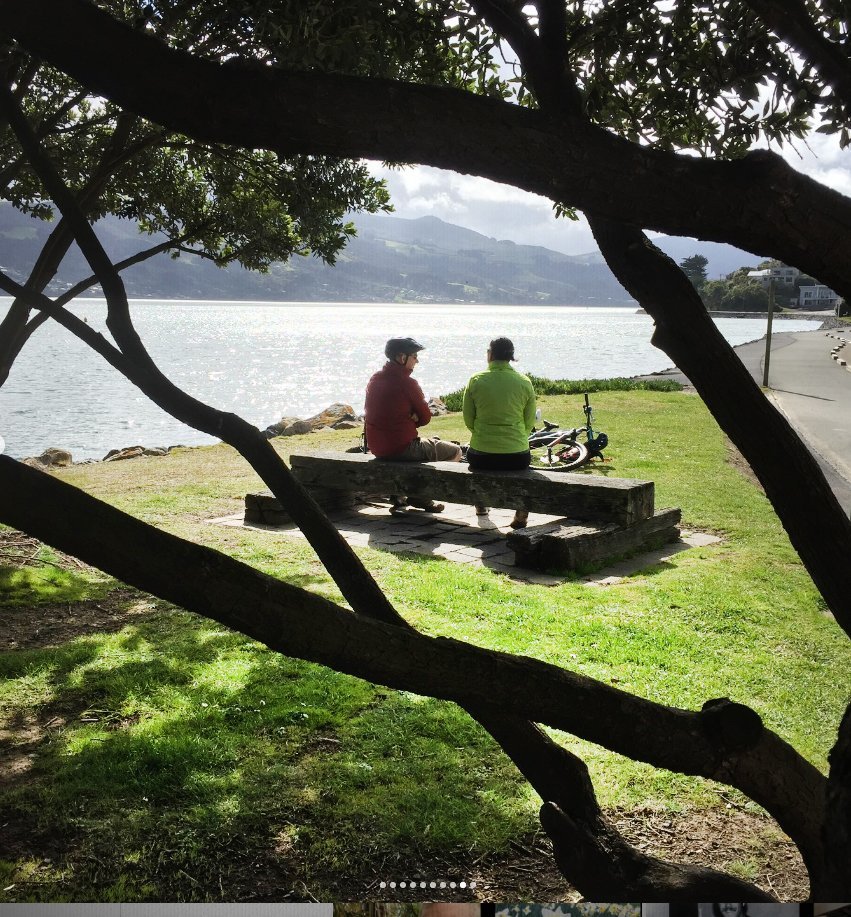
He says the wide cycle/walkway to the water’s edge allows him to pause and take in views of wildlife - everything from royal spoonbills to a sea lion thrashing with an octopus.
I too, discover how easy, compared to being in a car, it is to stop and take photographs. I glide alongside the sun-glinted waters, past Pudding Island and the now iconic boat shed decorated with a large king fisher mural, first created by local teenager Colin McAlpine in 1990 and freshened up by mural painter Jemima Pedro in 2013.
But cyclists do need to keep an eye on the trail - last November a man was seriously injured when he came off his bike and fell on to rocks.
Buxton says he’s very aware of the risk posed to cyclists who are too entranced with the views. "It’s a horrific thought - if you’re cycling you’ll be glancing out to the harbour, but you want to keep an eye on the ball."
Over the past decade, the roadway’s been widened up to 6m in some places to accommodate the shared path, the original rock seawall re-laid by hand. Teams of up to two dozen artisans wrestled more than 10,000 rocks into place for every 100m of neatly finished wall.
The wall is regularly broken up by sets of wide concrete stairs, providing access points to the harbour that weren’t there before.
As a keen boatie, Buxton says the stairs are essential for access to the water, because the new wall is steeper than the original. "The people in the rescue boat were a bit worried about the steepness of that wall and if someone got washed against it, you’d be hard-pressed to clamber down and rescue them."

With no information panel on hand, one might be tempted to believe this original-looking wall was built by some of the 200-plus Māori prisoners transported to Dunedin between 1869 and 1879, many imprisoned for resisting the confiscation of Taranaki lands by European settlers.
But the actual details as to who built which parts of the wall and when, seem to be somewhat lost in time. A Dunedin City Council spokesperson says it built the boardwalk around the wall simply because the council understands it to be historic.
Heritage New Zealand Pouhere Taonga says the original wall running all the way from Dunedin to just shy of Portobello was actually built by private contractors working for the Otago Provincial Council.
Whatever its history, waters at high tide continue to lap quietly against the old roughly-hewn rocks - the hefty stones testament to the hard work by some unknown labourers more than 140 years ago.
About 90 minutes into my journey, I arrive in central Dunedin. With much of the way from Dunedin city to Port Chalmers now complete, I have the option to continue riding for another 90 minutes to complete my journey or catch a $1 bus back - the bike rack on the front of the bus has room for two cycles.
While much of the shared path on the peninsula side was funded by the Dunedin City Council, the majority of the Port Chalmers’ side has been paid for by Waka Kotahi.
Credit for kick-starting the campaign for the shared path to Port Chalmers goes, in part, to a small group called The Harbour Cycle Network. City councillor Steve Walker is one member who campaigned at regular funding rounds to have parts of the western side built.
"We were never going to get the whole thing in one go, so it was a case of getting the agencies to admit there was a need," he says.

While Waka Kotahi footed much of that bill, Steve Walker says joint funding was required to get the project rolling. "It was additionally funded by the ORC and DCC - which you would never get them to do now - and Port Otago also came to the party."
This first section to Ravensbourne became popular quickly. A people-counter suggests usage is now on a daily average of more than 500 pedestrians and cyclists. Walker says that first success made the extension of the shared path all the way to Port Chalmers a more attainable objective. "People started asking: ‘Why does it just stop here at Ravey?’."
Walker commutes by bike most days between Port Chalmers and central Dunedin, and, like Robert Buxton of Macandrew Bay, he appreciates the chance to pause and view the wildlife, having spotted stingrays gliding through the water, as well as sea lions and bird life foraging along the shore. He’s confident the end result will be what he describes as "one of the best city-based cycle/walkways, not only in New Zealand, but in the world".
Waka Kotahi SH88 Safety Project senior project manager Jason Forbes agrees, saying the agency is proud of its contribution to the completion of the later sections between Ravenbourne and Port Chalmers. He describes it as "a world class asset for Dunedin where people can bike or walk on a safe, well-lit asphalted pathway".
While the speed limit was reduced on parts of the road to Port Chalmers from 100kmh to 80kmh some decades ago, the ongoing objective of Waka Kotahi has been to continue improving cycle and pedestrian safety along the busy stretch of road.
In addition, Forbes says Waka Kotahi recognises the benefits of "more people cycling and walking, for both the local and wider Dunedin community, as well as visitors to the city".
The cycleway reached St Leonards in 2012.
The most complex and expensive part of the shared path - the 5km stretch between St Leonards and Port Chalmers - was saved for last, as more than 2.5km of railway needed to be shifted between St Leonards and Curles Bay and between Sawyers Bay and Port Chalmers, to provide space for the path.

Much of the shared path along the western side of the harbour, Te Ara Moana, travels in a relatively straight direction beside the railway line, sharing causeways to cross the small coastal bays. When I pause at a bridge to look down into the water, I can make out sea tulips. These are actually primitive animals which do look a lot like tulips, locked onto the rocks, filter-feeding for their meal.
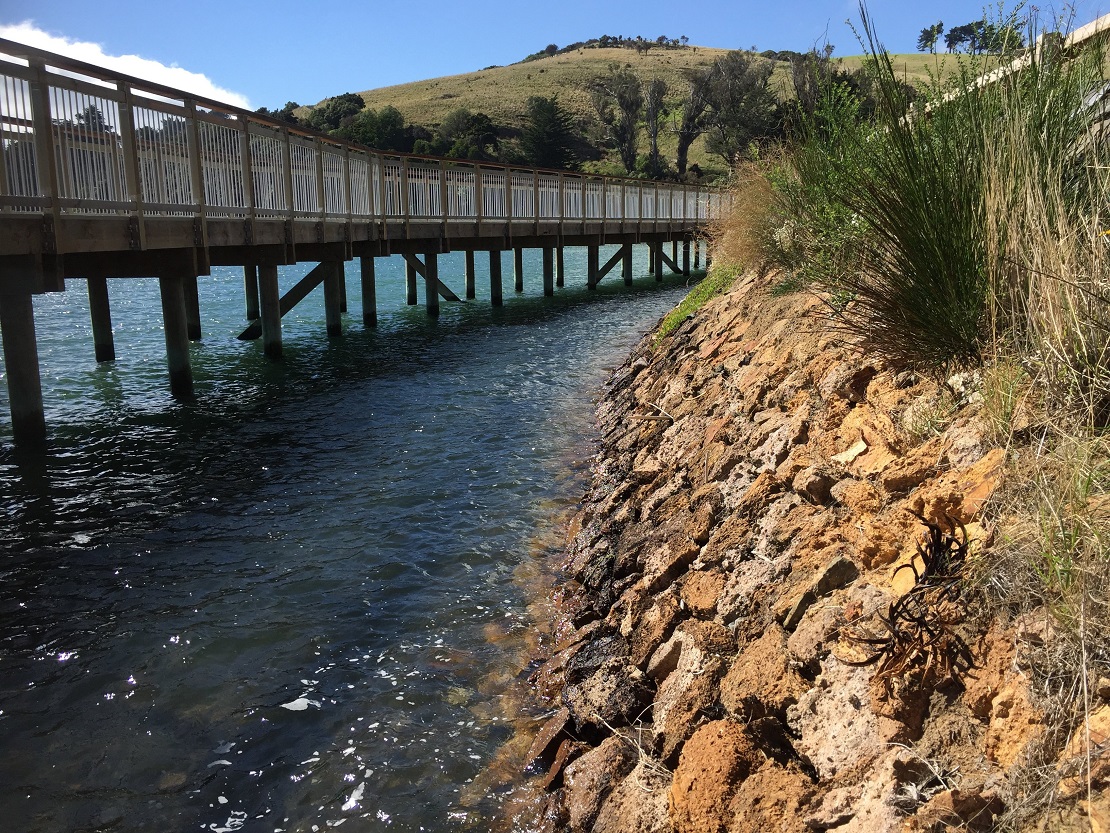
At the Blanket Bay inlet, 600m of boardwalk has been built to preserve an old wall. The new installation is to include a viewing platform with information panels about the area.
"It’s an important part of the harbour edge," says Forbes of the historic seawall, which was built as part of the Dunedin & Port Chalmers Railway in the early 1870s.
Forbes says where the main road cuts through the hill at Roseneath, a new 2.5m high retaining wall provides "a unique space to showcase some of Dunedin’s great artistic talent".
Commissioned by Waka Kotahi, and the panels feature a local taniwha as depicted by Otago artist Simon Kaan.
The mythical serpent, Matamata, was the guardian of the spirit of Kāti Māmoe chief Te Rakitauneke. Having lost its master, it is said to have swum down the Taieri River, its wriggling forming the sharp bends and twists in the river, as well as scooping out Otago Harbour.
Arriving at Port Chalmers, I have the option of cycling to my car parked at Back Beach via the township, or I can take the gravelled Peninsula Beach Road with slightly elevated views across the nearby harbour islands.
At the Back Beach carpark Rachel McGregor has just finished for the day and is loading the MV Sootychaser on a trailer. She reflects on the shared path’s upcoming completion, and wonders if the increase in numbers will be a challenge.

And if the enthusiasm of others is anything to go by, the shared path may well become a valuable asset for Dunedin’s commuters, tourists and weekend riders alike.
Te Aka Ōtākou
• Distance covered: Portobello to Back Beach, Port Chalmers: 32km.
• Duration on pedal-powered cycle allowing for stops to take in the views: 3+ hours (about 90 minutes for each side of the harbour).
• Typical width of asphalted path: 3m.
• Usage as counted near Water of Leith: an average of more than 500 walkers and cyclist per day.
• Official opening of last 5km section between St Leonards and Port Chalmers: Currently scheduled for late next month.
Before retiring, Rudy Adrian worked as a video journalist with the Otago Daily Times.


