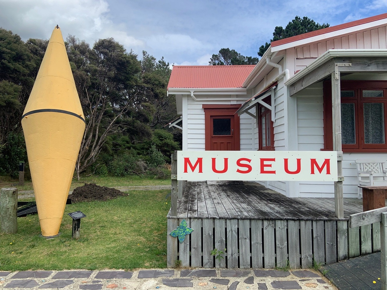
By the entrance to the museum at Claris is a piece of maritime treasure, the mooring buoy of the good ship Tiri, which started broadcasting from international waters off Aotea Great Barrier in December 1966 as Radio Hauraki New Zealand’s first 24-hour radio station. At the time, the government-run New Zealand Broadcasting Service had a monopoly on radio licences. Tiri was damaged beyond repair by a storm in January 1968 but the pirate Radio Hauraki resumed broadcasts from another ship, Tiri II, until it too went aground in a storm a few months later. In 1970, the government lifted the NZBS monopoly, allowing Radio Hauraki to broadcast legally from the mainland. Photos: Neville Peat
After numerous hazy glimpses of it from the mainland and from boats over the years, Dunedin writer Neville Peat made his first visit last summer to Aotea Great Barrier Island north of Auckland.
Let's start with the islanders’ four-finger wave.
As you drive your rental car away from Claris airport or the Tryphena ferry wharf, it may be one of the first signs of hospitality you encounter on Aotea Great Barrier Island.
It’s a friendly if fleeting wave on an island renowned for its winding hill roads and tight corners, where driving is an arm-wrestle and the locals are likely to raise four fingers while cornering with their thumb latched to the steering wheel.
Some 40km long, the Barrier as its commonly called is a key component of the islands forming the Hauraki Gulf. It also happens to be the sixth-largest island in our archipelago, at 285 sq km.
Stewart Island/Rakiura is third-ranked for size and Chatham/Rekohu and Auckland Island/Motu Maha in the subantarctic region are fourth- and fifth-largest respectively.
Geographically, the Barrier’s value is in its location due north of the Coromandel Peninsula.
James Cook, in 1769, perceived it as a barrier to the worst storms coming off the Pacific Ocean providing protection for mariners in the Hauraki Gulf.
Before the Covid lockdowns, the resident population was reckoned to be around 800.
Scores of Aucklanders sought sanctuary on the island then and many who could work from home, chose to stay, boosting the population by 50%.
You can fly to Aotea Great Barrier from Auckland in less than an hour but with Mary, my wife, who’d visited the Barrier in the 1980s, I was keen to take the vehicle ferry, a more interesting prospect than flying. So we lined up with 10 other passengers at the ferry’s Auckland terminal for a 6.30am sailing. More a small freighter than a tourist ship, the Sealink vessel Island Navigator has a lounge for passengers and toasted sandwiches available in the galley area, but otherwise this is a no-frills experience lasting close to five hours.
For tracking the ship’s progress north on the Hauraki Gulf you can look at a large nautical chart in the lounge. There’s a lot going on in the gulf besides shipping. For one thing its a hotspot for seabirds. New Zealand, seabird capital of the world, has considerably more seabird species than land birds and a good number are on display during our voyage. A friendly northwest breeze stirring up whitecaps is ideal for seabird foraging. Gannets perform vertical spearfishing dives, their 1.8-metre wings folded. Sooty shearwaters/tītī and the less common black petrel/tāiko range widely. Tiny storm petrels appear to dance on water in the wave troughs. In 2003, a dainty New Zealand storm petrel, thought extinct for over 100 years, was identified in the gulf, and in 2013 breeding was confirmed on Little Barrier Island/Hauturu-o-Toi, an important wildlife sanctuary.
Other marine life we saw included pods of bottlenose and common dolphins, which enjoyed racing the ship for a while.
By the time we reached the wharf at Tryphena at the southern end of the island the weather was warming nicely, bordering on subtropical. Rental car operator Orla Cumisky had a vehicle for us and we filled in the paperwork on the bonnet of her SUV. Like the many multi-taskers on the island, Irish-born Orla co-owns the Currach pub and restaurant at Tryphena, runs a rental car business and contributes to various volunteer organisations while bringing up three children with her partner.
The largest village on the island, Tryphena has two grocery stores, a New Zealand Post shop with a wall of 120 metal red mail boxes, a petrol station and garage, a school, a couple of cafes and of course the iconic Irish pub that started out life 120 years ago as a farmstead dwelling.

We checked in at our lodgings a short drive from Tryphenas commercial centre then walked across the road to feel the water in the bay, which was a stunning teal colour typical of sandy-bottomed bays in the tropics.
I got talking to a local young man watching out for his two kids playing in the shallows. He was descended from one of the early European settler families.
Farming and forestry, he said, had stripped away a lot of the native kauri forest but the indigenous forest was coming back big-time. He had returned to the Barrier after several years on the mainland so his children could experience what he’d had growing up.
Next day, motivated by our encounter with the uncommon banded rails, we take the main road north to Medlands Beach to see more of the island’s birdlife.
We weren’t disappointed.
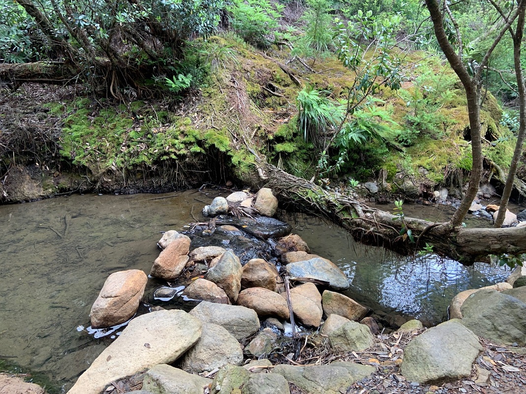
Near the Great Barrier Island camping ground at the end of a side road there’s a footbridge over the Oruawharo Creek estuary and we followed a foreshore path for almost a kilometre. We saw 10 native bird species, the rarest being a pair of brown teal/pateke foraging in a paddock, and a few New Zealand dotterels/tuturiwhatu seeking out a feed of sand hoppers on the beach in the company of red-billed gulls/tarapunga and pied oystercatchers/torea. For such a small area the bird life was amazingly diverse kingfisher/kotare, welcome swallow, kaka, pukeko, a spur-winged plover pair with four chicks, and a banded rail with a young one.
The rails sometimes cross the roads, scurrying like the road runners of cartoon fame. They do fly, but mostly at night.
Back on the main road to Tryphena, near where it negotiates a saddle, road signs advertise a walk to lofty Station Rock, 293m above sea level.

By contrast, further north on the road to Port Fitzroy, we drove to a high point in a mountain range and took a fairly short walk by way of a sequence of wooden steps (more than 150 in all) to reach a landscape feature called Windy Canyon. The Barrier’s tallest peak, Hirakimata/Mt Hobson (627m), is in the middle distance. For us, the canyon was more misty and mysterious than windy. A bonus on reaching the lookout point is encountering one of the island’s two endemic plant species, a tree daisy, found wild only on Great Barrier Island. In summer its small flowers, white with purple centres, are easy to spot.
Hirakimata/Mt Hobson is the high point of a three-day wilderness tramp that cuts through the mountainous middle of the island. The bulk of it is Aotea Conservation Park. Some locals think it deserves recognition as one of the country’s Great Walks. A good 60% of the island is public land managed by the Department of Conservation or the local board. The board reports to Auckland Council, and next day I caught up with one of its elected members, Patrick O’Shay, at the council office at Claris. Patrick was working through a meeting agenda. A multi-tasker, he works on the family farm and is a volunteer on the Barrier’s impressive waste management/recycling project, located in the wooded outskirts of Claris. Zero waste by 2040 is the project’s catch-cry.
Nature conservation is a preoccupation for many residents who work on a voluntary basis, in tandem with Doc staff, to control animal pests. Fortunately the island is free of possums, mustelids (stoat, ferret, weasel) and hedgehogs but there is a major push to trap or poison feral cats and rats.
Government and council funding of over $5 million enables the project to operate at landscape scale largely through the Jobs for Nature programme.
The challenges keep coming, though. In 2021, a mat-forming marine weed called Caulerpa was discovered for the first time in New Zealand on the southeast Barrier coastline. It spreads at an alarming rate and will be difficult to control. Caulerpa can travel as fragments attached to boat hulls. Of major concern too is kauri dieback disease. You can’t miss the footwear cleaning stations at strategic track entrances.
In the 1970s, a new kind of land-use found a footing alongside farming and plantation forestry.
A dozen mainland couples, alternative lifestylers who became more familiarly known as hippies over the hill, took the opportunity to create a communal settlement, each building a house and garden on 3000sq m of land.
The year was 1971 so they were ahead of the Ohu communes programme introduced by the Labour government four years later.
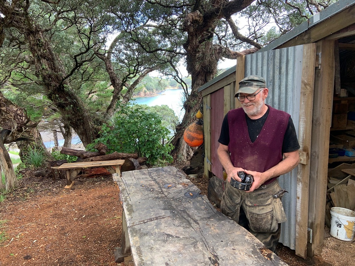
Peter Edmonds, a painter and artistic woodworker, and artist Fenella Christian were among the couples. They still live on their land and run a seaside gallery called The Black Cow at Schooner Bay.
What stands out to visitors to their house is the amazing rate of native bush regeneration in just 50 years. House and garden are overtopped now by forest featuring trees like pohutukawa, kauri, nikau palm, rewarewa/New Zealand honeysuckle and big-leaved tropical-looking titoki, whose grape-sized fruit are favoured by kereru/New Zealand wood pigeon.
Peter and Fenella say locals felt threatened by the commune’s presence back in the 1970s, when the resident population of the Barrier was just 250. We’re locals now.
In the late 1980s, my wife Mary visited the Barrier. Back then she made contact with two nurse/midwives on the island whom she had worked with a few years earlier at St Helens Maternity Hospital in Auckland, Leonie Howie and Adele Robertson. She was interested to reconnect with them on this visit having heard about the book they had co-written about the life of Great Barrier Island nurses, published in 2017. Leonie and Adele, rural nurse specialists, together with Leonie’s husband, the late Dr Ivan Howie, had set up an innovative team that ran medical centres at Claris and Port Fitzroy. Aotea Health (the Health Team) are contracted to provide the services, and a Health Trust owns the buildings, equipment and vehicles on behalf of the community. Despite the isolation and spread-out population, the Barrier health service is able to provide primary health care, cradle to grave, on a 24/7 basis.
In emergencies, contact can be made with Auckland Hospital for urgent advice and if necessary rapid transfers by helicopter (30 minutes to Auckland Hospital) or by fixed-wing aircraft.
In short, the Barrier is in good shape as far as health services go.
Our week on the Barrier sped by. While dropping off the rental car at Claris Airport on the way to the Auckland ferry departing from Port Fitzroy, we spent an hour at the island’s Gray House Museum, aware we had left one of the island’s visitor gems to last. Maybe we should have started our visit there.
A panel at the museum summed up the Barrier community as resilient, resourceful pioneers, artists, environmentalists and free spirits. And don’t forget, too, the friendly four-finger waves.