
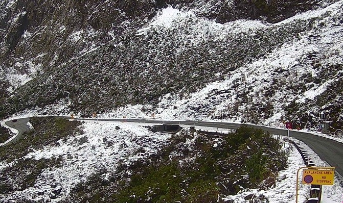
A snow-hit Milford Road is closed again on Friday, as heavy rain has heightened the avalanche risk in the area.
It's the third time conditions have affected State Highway 94 this week. The alpine road reopened this morning but was shut again from East Gate (Hollyford Road Junction) to Donne River Bridge (Westgate) at 5pm.
The avalanche hazard had been at low for most of the day but was raised to moderate by 5pm, due to forecast rain overnight and into Saturday morning, the Milford Road Alliance advised.
The highway was expected to open again mid-morning on Saturday once an avalanche hazard evaluation was completed.
"Please take extra care."
A heavy rain watch was in place for Fiordland from tonight. MetService said periods of heavy rain were forecast from 9pm tonight until 7am tomorrow, and the amounts may approach warning criteria. More heavy rain was expected from Sunday until Tuesday.
Heavy rain was also expected about the headwaters of the Otago lakes and rivers from 10pm on Friday until 6am on Saturday. Rainfall amounts may approach warning criteria within 15km east of the main divide.
Strong winds were likely for Southland, northwest of Winton and Fiordland, as well as the Queenstown Lakes district and Central Otago, west of Alexandra, from midnight on Friday until 6am tomorrow. North to northwesterly winds may approach severe gale in exposed places.
Forecast for the Homer Tunnel area
Today: Showers, turning to rain
Saturday: Heavy rain at first, easing to showers
Sunday: Rain with strong NW winds
Monday: Rain, heavy at times, with strong NW winds
Heavy rain, strong winds for West Coast and Canterbury
MetService has issued a heavy rain warning for the ranges of the Westland District, and the headwaters of the Canterbury lakes and rivers from Arthur's Pass southwards, from 2am until about 6pm on Saturday.
In Westland, between 160mm to 200mm of rain was forecast. Peak rates of 20 to 25mm/h were expected on Saturday afternoon. Further periods of heavy rain were expected from Sunday until Tuesday.
In Canterbury, expect 160mm to 200mm of rain about the main divide, and 80mm to 100mm within 20km farther east. Peak rates of 20 to 25mm/h expected early Saturday morning about the divide. The snow level would be around 1600 metres.
Streams and rivers may rise rapidly. Surface flooding, slips, and difficult driving conditions were possible.
Strong winds may also buffet the Canterbury High Country from 1am to 1pm on Saturday, bringing severe gale northwesterlies that may gust up to 120km/h in exposed places.
Damage to trees, powerlines and unsecured structures were possible. Driving may be difficult, especially for high-sided vehicles and motorcycles and care should be taken, MetService advised.
Meanwhile, a heavy rain watch has been issued for Tasman northwest of Motueka and the Grey and Buller districts from 3pm on Saturday until 1am on Sunday.
- ODT Online


