July has begun with a cold snap, with snow falling on the Crown Range and other areas of the South likely to be affected today and into tomorrow.
MetService meteorologist Clare O’Connor said a trough of low pressure carrying rain would move northwards over the South Island early this morning, followed by much colder southerly winds.
"As that cold air cuts under the warmer air, the moisture leads to snow production."
Temperatures were expected to drop to nearly zero in inland Otago and widespread snow forecast to fall to 600 metres, affecting some higher roads today.

Chains must be carried.
MetService said between 4cm and 8cm of snow was expected to fall on the road above about 800 metres, with lesser amounts down to about 600 metres until 2pm. Another 2cm was forecast to accumulate on the road above about 600 metres until 1am on Tuesday.
Grit trucks and snow ploughs were patrolling as needed, the QLDC spokesman said."All other roads in the district are open, but wet with heavy rainfall in places. We have surface water on roads around Whakatipu and on Haast and Lindis passes."

Up to 12cm of snow had been forecast for the Lindis Pass (State Highway 8) above 800 metres, with lesser amounts down to about 600 metres until 2pm. A further 1cm to 3cm was expected until 2am on Tuesday.
A heavy snow watch is in place for Central Otago northwest of Alexandra including the Queenstown Lakes, also the MacKenzie Basin, with periods of heavy snow above 800 metres, MetService said.
The Danseys Pass Road in Central Otago is restricted to 4WD vehicles (from the gates past the Danseys Pass Hotel) due to snow.
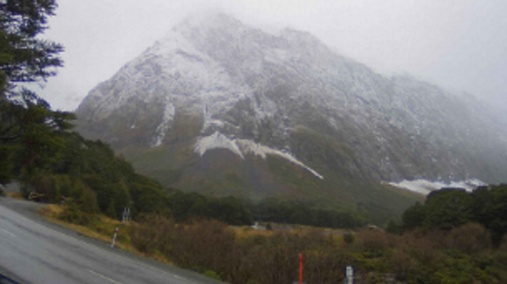
The Milford Road is open from East Gate (Hollyford) to Donne River (Westgate). Snow was forecast overnight and chains must be carried from 6pm today.
A spokesman for the Milford Road/ New Zealand Transport Agency said there were few cold days ahead and road users should expect black ice and grit trucks operating. Please drive with caution.
Canterbury alpine highways Porters Pass and Arthur's Pass (both SH73) and the Lewis Pass (SH7) were set to get 1cm overnight, as was the Desert Road in the North Island.
Flooding in Wānaka
Surface flooding is a hazard on many roads in Wānaka as heavy rain, which began last night, pummelled the town.
The rain filled a developer's water retention plant to over-capacity, forcing contractors to release water onto a road, flooding gardens and threatening homes this morning.
A Fire and Emergency NZ spokesperson said volunteer crews were called to a property in Aubrey Rd about 8.45am.
Meanwhile, heavy rain warnings were in place for the headwaters of the Otago lakes and rivers today.
Up to 140mm of rain was expected about the main divide, and up to 100mm was expected within 20km east of the main divide until 8am.
"Further rain is likely during Monday morning and afternoon, but this is likely to fall as snow on the ranges, MetService meteorologist Clare O’Connor said.
"Streams and rivers may rise rapidly. Surface flooding, slips, and difficult driving conditions are possible. Avoid low-lying areas and drive cautiously."
There were heavy rain warnings in place about Fiordland and north of Doubtful Sound overnight as well, where up to 150mm of rain was forecast.
- additional reporting by Regan Harris and ODT Online