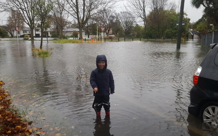
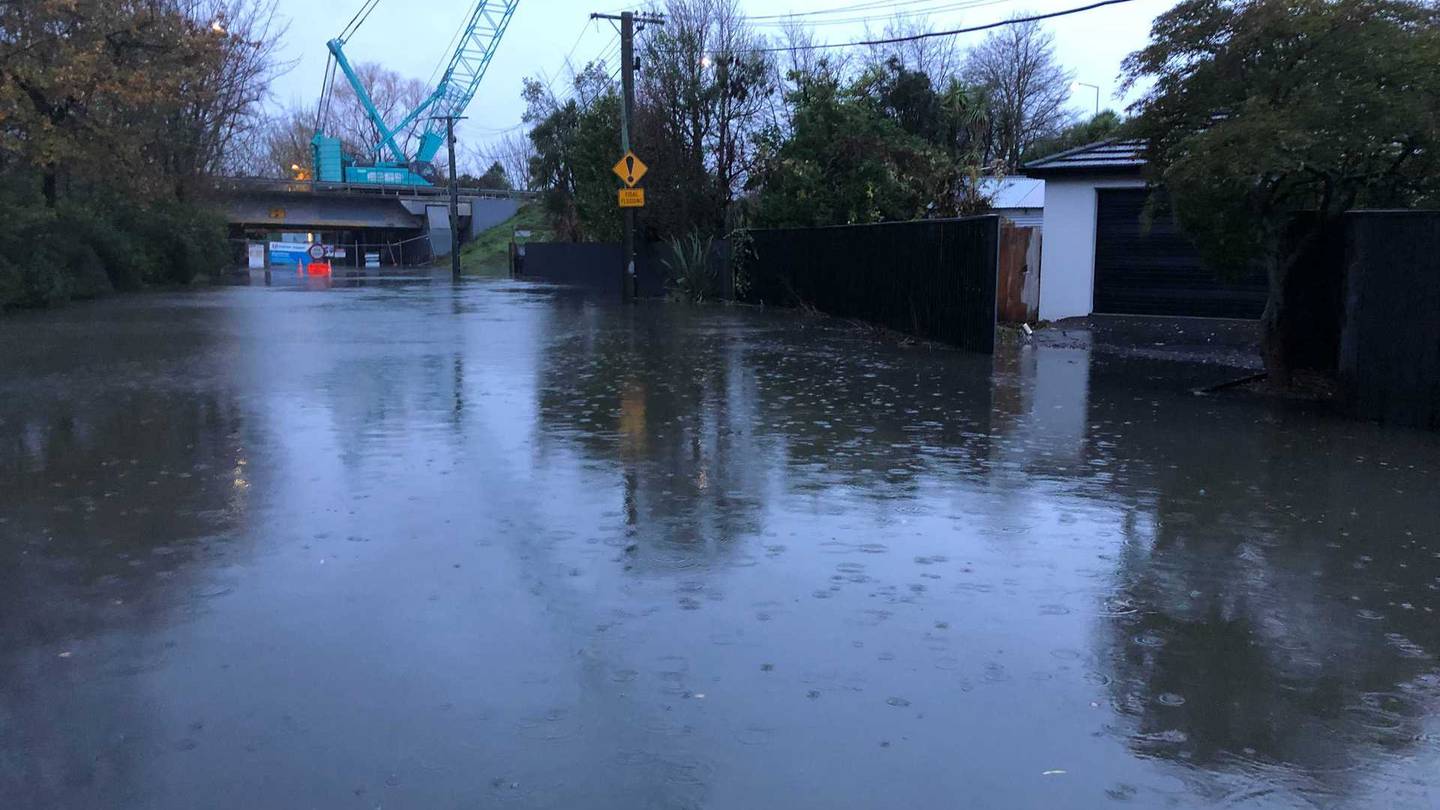
A state of emergency has now been declared for the entire Canterbury region as heavy rain continues to fall.
- MetService weather updates and warnings
- Check State Highways
- Sign up for flood alerts at Canterbury regional council
Canterbury Civil Defence Emergency Management group controller Neville Reilly confirmed the decision, saying other local authorities had been considering declaring states of emergency.
The Waimakariri District Council has announced that conditions are rapidly deteriorating and evacuations are set to begin."The Eyre River stop banks from Wolffs Rd are at risk of failing. Everyone along the river from Wolffs Road and north of the Eyre River to North Eyre Road must leave immediately," a council statement read.
"Fernside residents between Mt Thomas Road, Oxford Road and Merton Road should evacuate immediately. Rangiora urban areas are deemed safe."
The council advised residents to check council websites if they need to evacuate. Evacuation centres are at the Mandeville Sports Centre and Rangiora Baptist Church.
Evacuations were also in force in rural areas around Ashburton, where about 20 households had self evacuated.
The state of emergency declaration meant that people could be forced to evacuate their homes if they refused.
Rescue crews have recovered multiple people trapped by floodwaters, while Timaru and Ashburton have declared a state of emergency for seven days.
More than 50 schools and kura in Canterbury will close tomorrow due to the flooding.
The Ministry of Education says another 24 early learning services have confirmed they will not be open.
It said any closure is a matter for each school board or service manager to decide.
A Ministry spokesperson says many have indicated they will make a final decision early tomorrow morning.
At a news conference on Sunday afternoon, Ashburton Mayor Neil Brown said the stopbanks were doing their job and there was good capacity remaining.
However, rain is being forecast to continue for another 24 hours in Mid Canterbury, which was declared a local state of emergency at 10.30am today.
Faafoi was in Ashburton on Sunday afternoon visiting the emergency management bunker set up at the Ashburton District Council.

It was a matter of watching water levels and giving early warning to communities if evacuation was required.
Brown said a lot of rain had fallen in the past 24 hours, mainly in the high country, and it was making its way through the district’s river systems.
Residents in a Selwyn settlement have evacuated and some rivers have breached their banks as as heavy rain continues to pelt Canterbury.
People throughout Canterbury are being urged to stay at home and not put themselves at risk. Police said emergency services are concerned people have been going out to look at the flooding and several people have had to be rescued.
The New Zealand Transport Agency was monitoring roads and bridges.
Brown said if residents were feeling unsafe in their homes they should call 111 or leave if it's safe to do so.
"If they're feeling unsafe they should call someone, get some advice or leave. We've planned for this."
MetService has a rare code-red warning in place - its highest alert level - as the deluge is expected to bring between 150 to 200mm of rain to Canterbury by late Monday morning. The Canterbury Plains and coast can expect a further 70 - 110mm.
Meteorologist Alwyn Bakker said between 300 and 400mm of rain will fall in total since Saturday.
"That is a lot of rain. this is a very significant event. We are definitely not out of the woods yet. This is going to be a very persistent event, it's going to be continuing through until Monday morning at this rate."
The rain has begun to cut some areas off and make roads impassable, and those living near Ashburton in particular have been being advised to keep a close eye on the situation and monitor updates.
There has also been significant rainfall affecting Waihi, Kakahu and Geraldine.

SPRINGFIELD, SELWYN HUT RESIDENTS EVACUATED
Evacuations are underway in the town of Springfield in the Selwyn District.
Local Civil Defence controller Douglas Marshall says people from the Selwyn Huts area were evacuated earlier in the day.
He says Fire and Emergency staff are now helping around 30 households in Springfield whose properties are threatened by floodwaters.
Earlier, Selwyn Civil Defence said river flows were high on the Selwyn River and a flood flow breakout above the huts settlement was likely to happen later on Sunday or overnight.
Civil Defence controller Gerard Moore said the main risk for the Upper Selwyn Huts community is that access to the settlement is only via Days Rd, which is expected to be cut off due to flooding.
“In flood conditions, the road will be impassable for cars and residents would not be able to leave the huts area. We don’t expect the huts settlement itself will be flooded. The evacuation will help us ensure that residents are safe and are not stuck at the huts for a prolonged period, if the river flows stay high.”
Residents are being encouraged to self-evacuate to friends and family if possible. The road will be closed after the evacuation order occurs and security will be in place, until it is safe for residents to return to their huts.

STATE OF EMERGENCY IN ASHBURTON AND TIMARU
The Mayor of Timaru wants people to stay off the roads tonight.
Nigel Bowen says the river flows are being monitored, and members of the Defence Force have arrived from Burnham Military Camp to help.
He says roads throughout the region are closed and people shouldn't be venturing out.
"Hunker down. Stay home. We don't want anyone out on the roads travelling at all - there are so many road outages at the moment.
"You can't travel on the State Highway between Temuka and Timaru. It's just best to stay at home."
There are multiple civil defence centres open in the area, including at Timaru's Southern Trust Events Centre on Morgans Road and in Temuka at Alpine Energy Stadium on the Temuka Domain.
All motel accommodation in Temuka is completely booked out.Two shelters are operating in Geraldine, one at Geraldine High School and one at St Andrews Church Hall, Cox Street.
Pets are allowed at ll civil defence shelters, as long as they are contained (ie in a crate).
Two Defence Force staff are joining the Timaru Civil Defence team to help with planning in case more evacuations are needed.
The local Civil Defence controller, Justin Bagust, says the planning is a vital part of the emergency effort.
"We're operating 24-7, a lot of the work they're doing now is coming up with tasking and an action plan for the next 12 to 16 hours and some thinking around what is the recovery effort going to be looking like."
Bagust says thanks to the state of emergency, police were able to help evacuate four people who were refusing to leave their flood-threatened home in Peel Forest.
Engineers are keeping a close watch on Ashburton River stopbanks that are currently funnelling major floodwaters through the town of Ashburton.
If they show signs of breaching, parts of Ashburton town and Tinwald would have to be evacuated.
Ashburton Mayor Neil Brown said the stopbanks were doing their job and there was good capacity remaining.
However, rain is being forecast to continue for another 24 hours in Mid Canterbury, which was declared a local state of emergency at 10.30am today.
Metservice reports that 60mm of rain fell in Ashburton yesterday and that another 75mm is forecast for today. Methven had 102mm yesterday. Timaru district has also declared a state of emergency and Selwyn is likely to follow.

Engineers are also keeping a watch on the Hinds River, normally dry but now in flood.
Brown said there was concern about the Ashburton River but the stopbanks were running at about half capacity.
Emergency management was planning for evacuations if need be. If the Ashburton River breaches its northern stopbank, floodwaters will run down Racecourse Road affecting 1700 people. If it breaches on the south side, 2200 people in Tinwald would be affected.
“Hopefully that does not happen.”
People are being advised to stay informed via civil defence and the Ashburton District Council’s website.
Information is key and river flows are being monitored, even where floodwaters have damaged flow meters.
Anyone who felt unsafe could self-evacuate and go the council’s welfare centre, which is being set up at the Hakatere marae.
Mr Brown said farmers were putting in some hard work around the district trying to beat the floodwaters. They were moving stock to higher ground and feeding out.
He said the persistent, heavy rain had generated a one in 100-year event, at least.
The stopbanks were designed to handle a one in 200-year event. He had never seen the Ashburton River as high as it was.

Police have asked people to stay home and not go sightseeing to see floodwaters. Many roads around the district are closed and schools will make a call later today if they will open tomorrow.
The Ashburton District Council has warned people in the Methven and Mount Somers areas to boil water used for drinking, food preparation and hygiene purposes.
Deputy Mayor Liz McMillan urged people to stay home and keep safe. She said the council was sending updates through text messages and posts on its Facebook page.
Meanwhile, Timaru District Council Civil Defence advised about 1pm on Sunday it had declared a state of emergency.
Areas particularly affected are the Geraldine Foothills, Geraldine and Temuka areas, as well as areas to the north of the district.
Timaru District Council and ECan staff are monitoring developments.
Due to surface flooding only emergency travel should be undertaken district wide. Please exercise caution and drive to the conditions. No unnecessary travel should be taken.
Residents in low lying areas near waterways should prepare for rising water, ensure safety of stock and be prepared to evacuate if required.
There are a growing number of road closures around the district, in particular in the Geraldine Winchester – Temuka areas, the district council advised.

In Christchurch, the Heathcote River breached its banks by Clarendon Terrace in Woolston on Sunday morning and there is also flooding at various points along the Avon.

The Christchurch City Council is urging people to drive slowly if they need to be out on the road, so that water is not pushed onto people's properties. People are advised to avoid walking or biking through surface water as there is a chance it could be contaminated with wastewater.
Council spokesperson Tim Drennan said flooding was likely to ease over the coming hours as the tide recedes but that next high tide will bring fresh flooding.
"Most of the flooding that we've had so far has been related to the king tides.
"High tide for this morning has passed and we expect to see the flooding situation ease. However, with the next high tide due at 8pm we expect to see flooding occurring again. If people have vehicles parked in areas affected by flooding this morning, we advise they move them this afternoon before the next high tide."
Up to 8am this morning, Christchurch and the Port Hills have received between 40 and 60mm of rain. Parts of Banks Peninsula have received close to 100mm. Rain is expected to continue falling throughout Sunday and Monday.
'DON'T PUT YOUR LIFE IN DANGER'
People throughout Canterbury are bring urged to stay home, "hunker down", and not put themselves or others at risk, after emergency services have had to rescue several people from floodwaters today.
A police bulletin said emergency services were concerned people have been leaving their homes to check out the flooding.Rescue crews safely retrieved a person trapped by heavy flooding in Walkhams Rd in Ashburton, RNZ reported.
Search and rescue crews also responded to the Ashburton Forks area after reports a person was stuck in a river just before 10am on Sunday. That person has also been safely rescued.
Farmer David Clark said he pulled people from their car, which was swept in floodwaters this morning, and neighbours rescued another farmer who was stranded when floodwaters rose quickly while he was moving stock to safety.
"Key message from Federated Farmers today is that safety is paramount. Don't put your own life in danger," he said.
"We've seen multiple rescues, with machinery having to go out in deep floodwaters to rescue people."
Police were also called to assist a fire crew in a rescue emergency on Walkhams Rd at 8am on Sunday morning, a spokeswoman said.

HOMES WITHOUT POWER
Almost three hundred homes in Canterbury are currently without power due to the heavy rain and winds hitting the area.
Overnight, there were about 2000 homes without power, but that is down to 277.
The outages are spread across the region with problems in Rolleston, Belfast, Halswell, Woolston, and Wainui on Banks Peninsula.

State Highway 73 from Springfield to Castle Hill in Canterbury is closed due to slips and flooding, the New Zealand Transport Agency tweeted on Sunday morning.
People are being asked to delay travelling between Christchurch and the West Coast, as the SH73 closure means a long detour via SH1 and SH7.
SH79 Geraldine to Fairlie, Route 72 Winchester – Geraldine are also closed on Sunday.
HEAVY SNOW
MetService also advised that the freezing level was forecast to be around 1800 metres on Sunday, before lowering to 1400 metres again on Monday.
Heavy snow is expected above the freezing level throughout the event, but it may fall as low as 1000 metres in some places at times, especially on Monday.
Snow is expected to continue to affect alpine passes on state highways on Sunday, MetService said.
FLOOD ALERTS
Canterbury residents wanting to sign up for any official flood alerts, including evacuation notices, can text the name of their local river to 3730.
For example, text RANGITATA to 3730 for updates about that river, or SELWYN to 3730 for updates on the flows of that one. The name of the river must be typed in uppercase letters. The other rivers for which these alerts are available, are: ASHBURTON, HINDS, PAREORA, RAKAIA, WAIHAO, WAIMAKARIRI, and WAITAKI.
The text alerts are provided free of charge by the Canterbury regional council.
- RNZ, Linda Clarke of the Ashburton Courier, ODT Online and NZ Herald


