The track from Elfin Bay is along the lakeside, and continues on behind the hut to Martin’s Bay, but about half a mile further on the Upper Hollyford track branches off to the left. The Routeburn track is reached by crossing the creek in front of the hut, while to go to Glade House one must follow the track which rises up the hill behind the hut from the north-west end.
This leads up to the north end of the Livingstone Range, also known as Key Summit. This is the key to the watershed of Otago, for to the north the Hollyford flows out to the West Coast; then the Eglinton River runs though Lakes Te Anau and Manapouri and the Waiau River to the south coast; finally the waters of the Greenstone flow through Lake Wakatipu and the Molyneux River to the east coast.
A visit to Howden is incomplete without a day to admire the view from the top. It is best to keep along the western side of the top, whence magnificent panoramas are unfolded in every direction. To the left of Christina can be seen the snowy dome of Students’ Peak, while just to the right is Mount Crosscut, behind which, is the source of the Hollyford at Gertrude Saddle.
Closer at hand, in the valley below, Lakes Fergus and Gunn, while above the former is tiny Lake Lochie. Lake Gunn drains out into the Eglinton Valley, whose park-like flats and clearings can be seen in the distance.
The saddle between Lake Lochie and the Hollyford is probably the lowest leading to the West Coast, being in the vicinity of only 1000 feet.
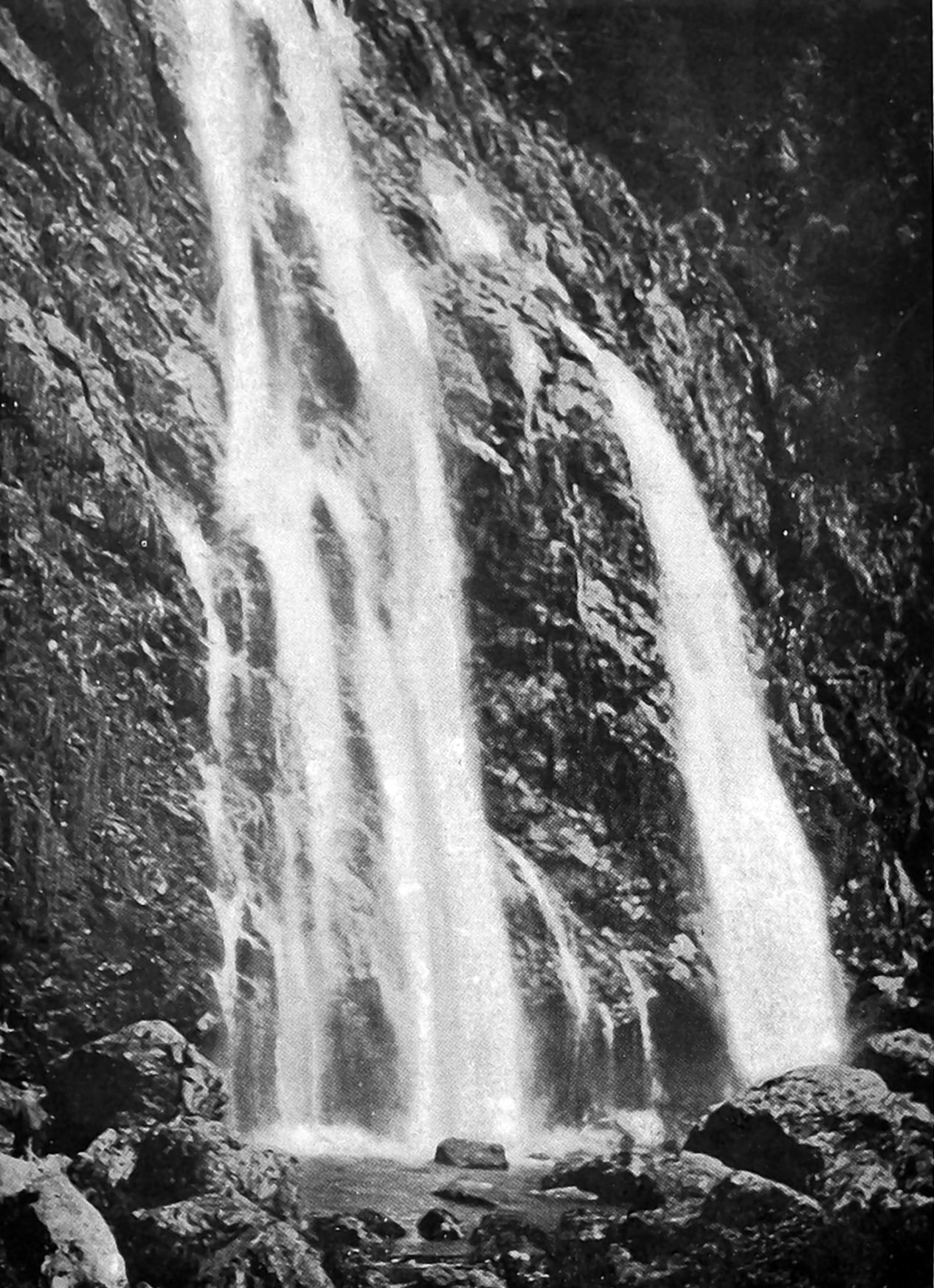
Besides this principal excursion from Howden, those who have the time and the inclination can devise numerous others along the various tracks. Less than half a day will suffice to visit the Earland Falls on the Routeburn Track.
A grouse home for grouse
The grouse liberated in Tongariro National Park last spring seem to be thriving, word having come recently from Waimarino that a hen bird with a fine brood of 14 chicks had been seen on the plains near the foot of Tauhungatahi. After many unsuccessful efforts grouse would therefore appear to have been at last acclimatised in the North Island. The three brace of birds were hand-reared in England and sent to Mr Massey by Lady Liverpool for liberation in the Tongariro National Park. They arrived in Wellington last September and were the first grouse to reach New Zealand alive. The honorary warden of the park (Mr John Cullen) took the birds to his cottage at Tongariro where he kept them in pens for about a fortnight, and then liberated them. The mother bird and chicks appear to be in excellent condition and, aided by a liberal diet of heather tips which form their principal food, are evidently taking kindly to acclimatisation.
Concern for causeway
On Sunday afternoons and holidays the road and bridge facing the Anderson’s Bay inlet are largely frequented, and at the bridge itself numbers of small boys indulge in the pastime of fishing. There is no doubt that on occasions the bridge is more congested than a level crossing in the city, but many motor drivers either wilfully or negligently fail to realise this. Yesterday afternoon a car coming up from the Peninsula went clean over the loins of a retriever dog, well-known in the district for many years as "Barney."
The car did not stop, although its driver must have known that he had struck something, as a Daily Times reporter, who was more than 100 yards away, heard the cry of the animal. It was badly injured — in fact, it appeared, fatally. The number of the car was taken.
If there is one part of the city environs which should carry danger signs it is the road and bridge dividing the harbour from the Anderson’s Bay inlet. — ODT, 13.4.1925
Compiled by Peter Dowden