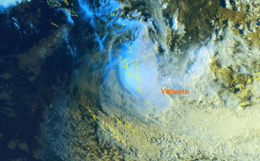
As of early Wednesday, Fiji Meteorological Service said the storm was passing over Pentecost Island and forecast to make landfall on Malekula Island.
The Vanuatu Meteorology and Geo-hazards Department has downgraded Lola to category 3.
But with the communications cut off, it was hard to know what the impact had been on those islands at this stage, Salwai told Morning Report.
On-site teams would be reporting back on conditions today, he said.
Vanuatu's National Disaster Management Office (NDMO) has activated offices in six provinces, ready to carry out a rapid assessment after the cyclone.
The capital, Port Vila, is on red alert and all government offices, markets, and banks are closed until further notice.
RNZ's Pacific Vanuatu correspondent said he had had reports from people on the island of Motalava in Torba province on Tuesday that winds damaged banana trees.
He said he was told the sea around the island was rough, and in some parts of the island waves were washing inland.
While the prime minister believed there was sufficient warning for people to shelter from the cyclone, many still had unrepaired homes from the previous cyclone and schools were operating as temporary shelters.
"Shelter will be very important, but probably food because this year we have three cyclones, two in the beginning of the year, Kevin and Judy, almost affected the whole islands of the country."
The three cyclones hitting the country so far this year was an indication of climate change, he said.
Lola downgraded to a category 3
At 5am local time Wednesday, severe tropical cyclone Lola was about 60km east of Malekula and 65km north northwest of Epi, the Vanuatu Meteorology and Geo-hazards Department said in its latest warning.
Winds close to the centre are estimated at 150kmh, gusting up to 205kmh within 38 nautical miles from the centre of the system and expected to affect the islands of Sanma, Penama, Malampa and Shefa in the next 24 hours, the meteorological office warning said.
Destructive storm-force winds of 185kmh gusting to 265kmh are within 60 nautical miles of the centre of the system and will affect Sanma, Penama, Malampa and Shefa later today.
Niwa principal scientist Chris Brandolino told Morning Report tropical cyclones tend to accelerate once they move out of the tropics.
While it has peaked in intensity, significant impacts could still be expected, even beyond the centre, he said.
"It will continue to weaken ... and that weakening trend will continue as it approaches New Caledonia say by Friday midday or sometime on Friday."
Why is this tropical cyclone earlier than the usual season?
The season for tropical cyclones starts in November and goes to April in the southern hemisphere.
But Brandolino said modelling of the climate conditions this time of the year suggested an intense one could form.
"There were indications that category five tropical cyclones could occur, because they occurred in years with similar conditions that we see now in terms of the overall climate, the overall conditions with the ocean and the atmosphere."
The average number of tropical cyclones during the season in the southwest Pacific region was nine, but the outlook was normal to above normal, with nine to 14 being possible, Brandolino said.
Brandolino said it was not clear what, if any, impacts the cyclone would have on New Zealand.
While Lola is weakening, cyclones can often experience a second life if they interact with another weather system.
"So there is a separate weather system forecast to move from the south and west over the Tasman sea, and it will interact with this tropical moisture, produce a new low, somewhere over the northern Tasman Sea or northeastern Tasman Sea.
"There is a chance we could see rain and winds for parts of the country. The jury is still out in terms of what, if any, impact that will have on Aotearoa New Zealand but it's certainly in the discussion."


