
Beryl struck the southeastern Caribbean at Category 4 strength on the Saffir-Simpson five-point scale, spiraling toward the Caribbean's Windward Islands and threatening devastating flooding as potentially deadly winds picked up speed.
"This is an extremely dangerous and life-threatening situation. Take action now to protect your life!" the US National Hurricane Center said in a post on Monday, urging residents in Grenada, the Grenadine Islands as well as Carriacou Island to shelter in place due to an expected rapid increase in wind force.
Across many islands that dot the Eastern Caribbean, residents boarded up windows, stocked up on food and filled their cars with fuel as the storm drew closer.
The Miami-based hurricane centre noted that hurricane-force winds spread out from Beryl's well-defined eye by up to 64km, with still-dangerous tropical storm force winds extending outward by another 201km.
Beryl's rapid rise marks an unusually fierce and early start to this year's Atlantic hurricane season, including the earliest Category 4 storm on record.
Scientists surveyed by Reuters see the powerful hurricane as a harbinger of an unusually active hurricane season made possible by record-high temperatures in the Atlantic Ocean.
"Climate change is loading the dice for more intense hurricanes to form," said Christopher Rozoff, an atmospheric scientist at the United States' National Center for Atmospheric Research in Boulder, Colorado.
Andra Garner, a New Jersey-based meteorologist, noted that Beryl jumped from a Category 1 to a Category 4 storm in less than 10 hours.
Leaders in the region sought to prepare locals for the worst, including the prime minister of St. Vincent and the Grenadines, Ralph Gonsalves. He said he was expecting a natural disaster that could continue for days.
"We have to wait this monster out," he said in an address to the nation.
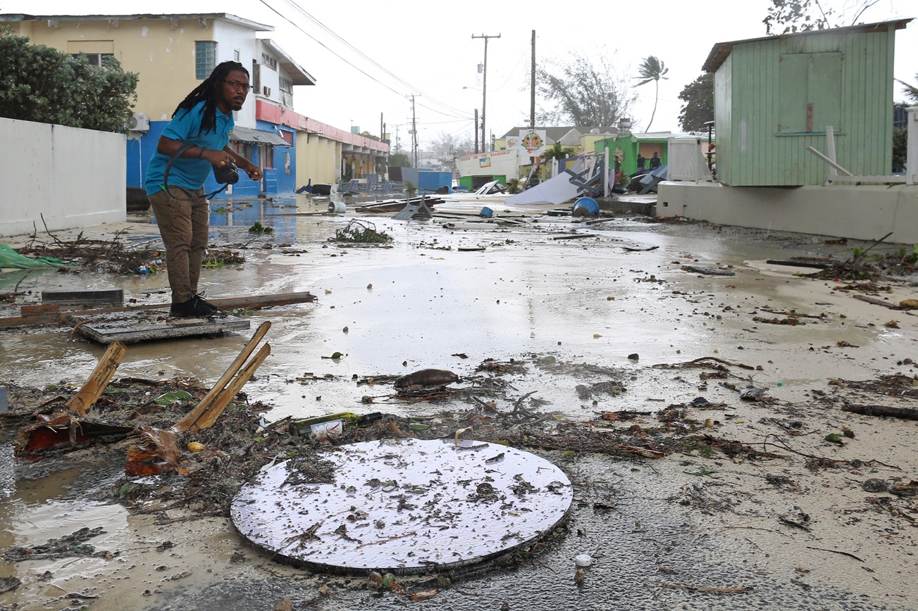
In the capital of Kingstown, conditions around the main harbour worsened on Monday morning (local time), with some damage to buildings reported, caused by intensifying winds. Video from the city showed waves crashing over a seawall and palm trees along the shore battered by the wind.
Beryl's maximum sustained wind speed had risen to 241kmh by Monday afternoon, with the weather phenomenon located about 105km northwest of Grenada.
Beryl was moving west-northwest at a speed of 32kmh, the US hurricane centre said, and was forecast to cross many of the central Caribbean's most populated islands through Wednesday as it barrels toward the Gulf of Mexico.
The core of the hurricane will likely bring "potentially catastrophic wind damage" as it moves through the Windward Islands, with St. Vincent and the Grenadines, and Grenada most at risk, according to the centre.
In the St. Vincent community of Prospect, damage reports included roofs ripped off of buildings, as well as power cuts in other parts of the island.
A Reuters reporter on Grenada said power was down across the island.
CLIMATE CHANGE'S FINGERPRINTS
Global warming has helped push temperatures in the North Atlantic to all-time highs, causing more surface water to evaporate, which in turn provides additional fuel for more intense hurricanes with higher wind speeds.
Scientists have already predicted that events like Beryl will grow more likely with climate change, meteorologist Garner said. Her research has shown that as water temperatures rose over the last five decades, it has become more than twice as likely for storms to jump from weak storms to major hurricanes in less than 24 hours.
The hurricane centre said hurricane warnings were in effect for St. Vincent and the Grenadines and Grenada, and a hurricane watch was issued for Jamaica.
In nearby Tobago, shelters were opened and schools closed on Monday.
"The eastern side of the island got the most battering and the seas remain dangerous. Fisherfolk got sufficient warning and were able to remove their boats from the water," said Curtis Douglas, President of the All Tobago Fisherfolk Association.
Only limited damage to hotel properties on the island has been reported so far, according to a local hotel and tourism group.
The hurricane was expected to bring 8 to 15cm of rain across Barbados and the Windward Islands throughout the day on Monday, with some areas seeing as much as 25cm, especially in the Grenadines, Tobago and Grenada.
In May, the US National Oceanic and Atmospheric Administration predicted above-normal hurricane activity in the Atlantic this year, also pointing to unseasonably high ocean temperatures.
Canadian travel blogger "Khanadians" Nauman Khan, in a video posted from his hotel early on Monday morning while on vacation in Barbados, described "really massive waves."
He said he had been talking with local residents. "Just knowing that people were taking it in their stride, this is a part of life in the West Indies ... it gave us some reassurance."


