Hundreds of Northland homes are without power after severe winds toppled trees and downed powerlines as wild weather bears down on New Zealand.
Heavy rain and strong winds linked to former Tropical Cyclone Tam are hitting the upper North Island, and the system is expected to bring damp skies to much of the country over the rest of the week.
MetService Meteorologist Silvia Martino said this morning said Tam's centre may not reach New Zealand but the country will feel its impact for days.
In an update about midday RNZ said power cuts were affecting about 1500 homes and businesses in Northland.
They include 749 in Ruatangata West, Ngarartunua, Kamo and Mataurau. Another 373 have had their power supply disrupted in Morningside and Whangārei.
Northpower has crews on the road trying to identify and fix the problems.
In Auckland, strong winds forced the closure of some Harbour Bridge lanes for a time, but NZ Transport Agency Waka Kotahi advised shortly after 11am they had all reopened.
In Coromandel, Civil Defence and Emergency manager Brian Carter said his team were actively monitoring their region.
He said the council’s Incident Management Team had been activated, and teams were implementing preparedness measures across the district, focusing on potential flooding and wind damage.
MetService midday update
In an update shortly after midday, MetService said Cyclone Tam had been officially reclassified early this afternoon as it moved south over cooler waters, changing the mechanisms driving the system.
"While Tam is no longer a tropical cyclone it remains a powerful and potentially damaging system with rainfall and strong winds expected over a wide area of the country over the days ahead."
MetService meteorologist Mmathapelo Makgabutlane said it was a two-pronged weather event bringing both heavy rain and strong winds, "with impacts from the one likely to intensify impacts from the other".
She said easterly and northeasterly winds were forecast to reach unusually high speeds in Northland and Auckland, increasing the risk of damage to trees, structures, and powerlines.
"Both regions remain under Orange Warnings for Strong Winds, and hazardous travel conditions are possible. Gusts near the Auckland Harbour Bridge may approach 100kmh today and could exceed that on Thursday."
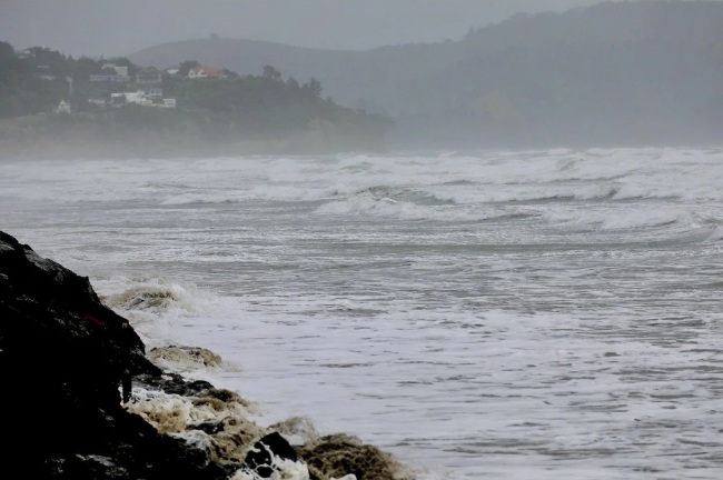
She said the strong winds would also drive dangerous sea and coastal conditions for the upper North Island, with large waves potentially leading to coastal inundation and erosion.
“The most likely areas for coastal impacts stretch from North Cape down to Coromandel, with the highest risk around high tide. People are encouraged to follow the advice of local authorities and avoid the coast if possible.”
- RNZ/APL