Kiwis are set to shiver this weekend with cold winds forecast to whip throughout the country.
MetService meteorologist John Law said Kiwis could expect a windy weekend ahead.
"The winds are all coming up from the southwesterly direction, so it's going to make it feel colder, especially for the likes of down towards Southland and Otago, those are where we are going to find the strongest winds.
"It will be quite showery as well and we might find some snow showers down to around 200m or so."
There was a strong weather watch and severe weather warning for these areas, Mr Law said.
"For today there is a strong wind warning for the likes of central Hawkes Bay and the Wairarapa. Those winds should ease away as we go through today, but it is going to be a case of really keeping a close eye on this southwesterly."
Mr Law said the southwesterly winds would also bring showers to places such as Auckland, and areas along the western side of the North Island, as well as parts of the West Coast and down towards Southland and in towards Otago, over the next couple of days.
"A lot of places like Canterbury, up towards Marlborough, and pretty much the eastern side of the North Island and the Bay of Plenty, it's dry weather, but this is quite cold air that comes through and it's going to be quite windy as well, so it's going to make it feel colder than it is.
"If you are out in the wind, especially down in that southern and eastern corner of the country, be aware there is going to be a fairly significant wind chill factor as we head through Saturday and Sunday.
"We've probably actually seen colder temperatures, but it is that combination of wind and cold temperatures which will make it pretty chilly as well."
Through the weekend and into Sunday, showers should start to ease off for those in the south, making way for finer weather, Mr Law said.
However, showers were still forecast for Auckland, Whangarei and Hamilton on Sunday.
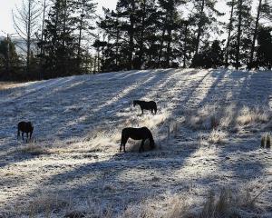
Meanwhile, snow fell on the Desert Rd yesterday, and last night temperatures dropped below freezing.
However, there was no road snowfall warning in place, and currently there was no snow on the Desert Rd, Mr Law said.
"The other things to bear in mind is as we go through the next few nights, as soon as we start to see that wind dropping down and some clearer skies coming through, those cold temperatures could leave quite a frosty start, particularly in those inland areas of the North Island and the South Island."
- Nikki Papatsoumas of NZME. News Service