


Key points
• MetService has downgraded its red rain warning to a yellow watch
• One main highway into Dunedin has reopened
• States of emergency have been declared in Dunedin and the Clutha District.
• About 100 people were evacuated from homes overnight. The St Clair Golf Course welfare centre is now closed.
• About 60 homes have been evacuated in South Dunedin but no more are expected.
• Slips near Ravensbourne and Macandrew Bay have affected water supplies. Tankers are available.
• Key harbour routes closed including SH88, Dunedin to Port Chalmers, and Portobello Rd.
• Multiple roads were closed across the city due to flooding and slips (Check DCC roads here).
In what will be a huge relief for Southerners, MetService has this evening announced that its red rain warning for parts of Otago has been downgraded to a watch.
The red warning - the first ever for Otago - covered Dunedin, North Otago, and coastal Clutha and had been extended until 11pm today. These areas are now under a yellow heavy rain watch until 9am tomorrow.
"Widespread heavy rain has cleared. However, occasional showers are expected to affect the area tonight and tomorrow morning, one or two could be heavy. 10 to 15mm could accumulate in some places," MetService said.
"The yellow heavy rain watch for Clutha has been cancelled and the watch for Southland has been lifted."
MetService meteorologist John Law earlier said there was the possibility of a last big burst of rain in Dunedin about 7pm, but despite this, the worst was over.
He said skies would begin to clear overnight and into Saturday.
Emergency Management Otago Group Controller Matt Alley this evening said staff were closely monitoring rivers and tributaries to keep their “finger on the pulse” for responses.
Alley said rain had to ease before he could say when people could can return to their homes, but people with “addresses underwater” would have to wait beyond tonight.
He said South Dunedin, Clutha and all low-lying areas had been significantly impacted.
The Clutha River was being closely monitored, particularly around Balclutha.
"We’re expecting peak flows for the river to come between 2am and 8am tomorrow morning."
Alley said slips and damage to roads would hamper recovery efforts and the State Highway 1 closures north and south of Dunedin would be reassessed with NZTA "first thing in the morning".
- Video: Zoe Holgate
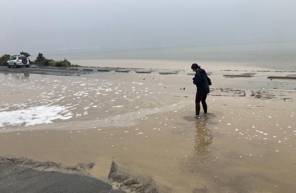
Earlier, Dunedin was reported as having had its wettest day in over a century.
About 100 people were evacuated from 60 homes, and following the declaration of a State of Emergency at 11.55pm last night, emergency staff, agencies and volunteers worked throughout the night.
Streets in the area of South Dunedin between Bayview Rd and Victoria Rd between Forbury Rd and East Ave have been the worst-hit.
Alley earlier today said about 140mm of rain had fallen in the past 48 hours — more than treble the average monthly rainfall for October.
He said a second rain peak was expected this afternoon and the rain was likely to continue until at least 9pm today.
‘‘There is rain through 9 o'clock tonight with another 40 to 60 millimetres of rain, with a couple of peaks between now and 12, and then another one later on early evening.
‘‘We believe we're in a good state now. The rain intensity doesn't look to be too bad, so I'm fairly confident that we should be able to make it through without any further problems or escalation.’’
The state of emergency was declared as the rain forced the evacuation of about 60 homes in South Dunedin.
Portobello Rd has been affected by numerous slips with trees down and flooding covering the road.
All people are safe and accounted for after a significant slip impacted two properties in Burkes Drive, Maia this morning.
The properties and those either side of the slip and one above were evacuated by Fire and Emergency New Zealand (Fenz) staff to Forsyth Barr Stadium.
Fenz firefighter Craig Geddes said the slip was still moving as a water main at the top of it continued to send large amounts of water down it.
Staff from Geotech and engineers were assessing it.
Government response
Speaking to media on Friday afternoon, Prime Minister Christopher Luxon said his thoughts were with people in Dunedin who are "wrestling with those floods and extreme weather events".
"As you know, Dunedin has declared a local state of emergency, our advice to everybody would be evacuate if you can and don't wait for the advice to do so.
He said Emergency Management Minister Mark Mitchell "has been on the ground there assessing what we may need to do from a government point of view in due course but for right now, it's about making sure everybody takes the advice they're given locally and respond to that".
Luxon said the rain events in Otago were still going on.
"What's important is the response right now and that's about making sure the council, who are doing a great job, our first responders, Civil Defence, who are doing a great job."
"But right now, our advice is, we'll worry about the recovery, but what we've really got to focus on right now is the response and that means actually making sure people are safe.
"We still have slips, we still have about 22 roads out of action, we've got 12 rivers of which most are receding but two are still on the rise, we've got weather still down there all throughout the course of the day into probably about 9pm tonight.
"So it's about monitoring, it's about making sure we've got the response, it's making sure locals understand, please, please, please follow the advice of the local Civil Defence.
"Also, use your common sense and evacuate if you need to evacuate and follow the advice very strongly.
"We will worry about the recovery and what the situation is afterwards but right now, we're still in the response phase before we move to a recovery phase."
'Quite scary'
Macandrew Rd resident Emma Paulo's backyard had been flooded and the water was approaching her front doorstep, where she had placed sandbags.
"It's not a nice sight to wake up to in the morning," she said.
She said the rain was "quite scary" and she had not thought it would get this bad.
She had never seen this much rain before in the time she had been living in Dunedin.
While her four children were a bit scared, they thought the rain was "pretty cool," Ms Paulo said.

"We're in a lake, pretty much."
Her 5-year-old son Wilfred had got a "massive fright" by the civil defence alarm, and from people banging on their door at 3am.
She believed the water level was about the same as during the 2015 flooding.
Much of the water appeared to have been flowing from a manhole in the street, since yesterday afternoon.
"It's obviously just got nowhere to go."
Rahab Brown, who also lives in Macandrew Rd, said she was planning on heading to the Civil Defence centre once her husband returned home.
The water was right at the edge of the front and back of her home.
She said cars driving along the road at speed were pushing water towards her property.
"If they just slowed down, we would be fine. This is weather for the ducks."
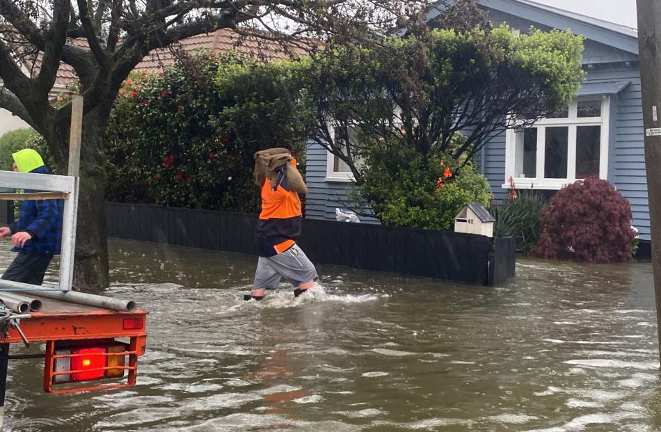
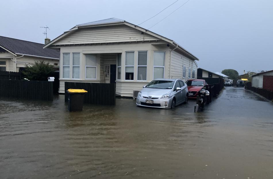
There is also significant flooding in Tainui, particularly Cranley St.
Residents in South Dunedin, particularly in Caversham in and around the areas near Hillside Rd and Surrey St, are still encouraged to self-evacuate to higher ground if they notice rising water.
About 80 people are at evacuation centres, including around 50 who were staying at the St Clair Golf Club.
Civil Defence Controller Scott MacLean said a welfare centre had been set up at at Forsyth Barr Stadium for those who had nowhere else to go.
“We have teams out on the ground helping and transporting people who are unable to travel to the stadium on their own,” Mr MacLean said
Mr MacLean said there was significant surface flooding across the city including Peninsula Road and around the Hoopers and Papanui Inlets, and in Green Island, Caversham, and Musselburgh suburbs. There were also reports of flooding in Kaikorai Valley.
"We’re keeping an eye on river levels as high tide (5.25am) approaches but we don’t think it will be much of an issue at this stage."
Mr MacLean reminded residents not to go out or travel unless it is absolutely necessary, and to be wary of flooded areas that may be deeper than people realise.
Water main bursts
A water main has ruptured on Otago Peninsula leaving a number of households from Irvine Rd out to Macandrew Bay and Portobello without water.
The pipeline has been isolated near The Cove. Contractors are investigating alternative water supply options for these areas.
Mr Maclean says it is believed that the water main was damaged in a landslip.
Key routes on either side of the harbour are closed because of landslides.
State Highway 88 from Forsyth Barr Stadium to Port Chalmers is closed because of a landslide at Maia.

There has been a landslide between Careys Bay and Deborah Bay which is covering half of Aramoana Road.
The culvert at the bottom of Harbour Tce and Aramoana Rd at Careys Bay is blocked and there is significant flooding across the road, so people should stay home or in a safe location.
People were asked not to drive through flooded areas and cause waves and problems for volunteers and emergency services. Surface flooding may be difficult to see, so people were advised not to travel unless absolutely necessary.
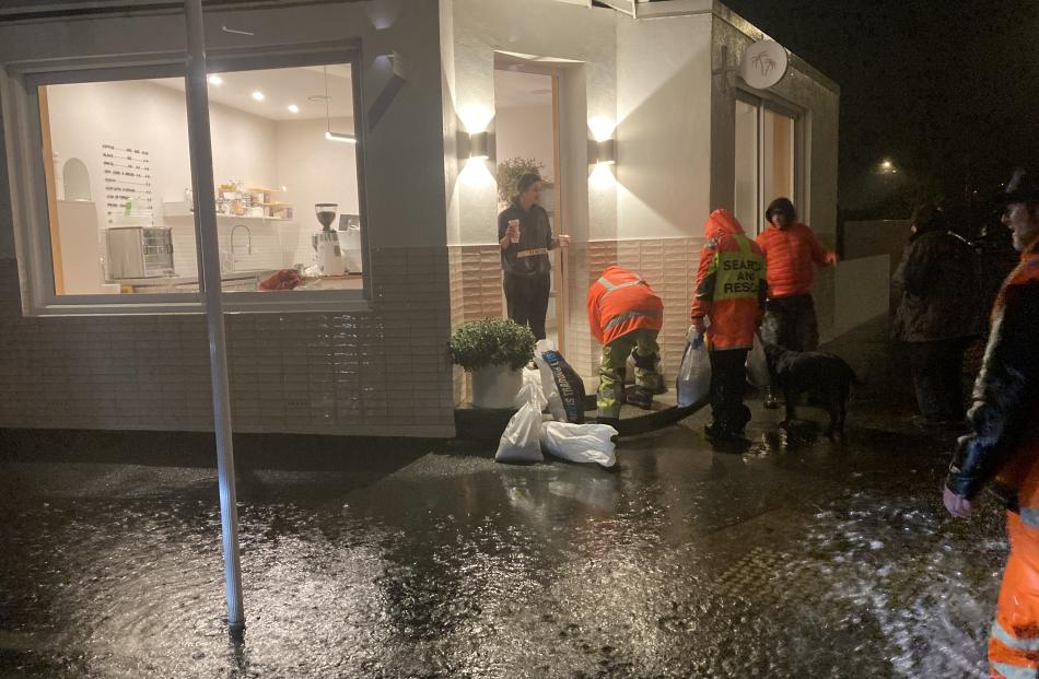
Sandbags continue to be available from South Dunedin (Ice Stadium), Mosgiel (Memorial Park/Gym carpark) and Middlemarch (Showgrounds) overnight. There was high demand in South Dunedin so people were asked to be patient.
Water conservation notice -West Harbour
All households in West Harbour, particularly from Ravensbourne to Careys Bay, are being told to conserve water.
Contractors and staff are heading out to urgently fix a break in the water supply pipe. In the meantime, people need to conserve water:
- Avoid showering, flushing toilets and washing dishes;
- Use water for drinking only.
“A collective effort to conserve water now will help us avoid the risk of running out or low on water. Our teams are working hard to get the issue fixed and support our community,” Controller Chris Henderson said.
"We have water tanks on the way for people to collect drinking water. People should bring their own containers to fill.
"We will keep the community updated."
Power out
Some residents on the Otago Peninsula remain without power.
Aurora Energy says there are power outages in Cape Saunders and Highcliff that have affected around 100 customers.
It aimed to have power restored by 4pm.
Dunedin streets closed
More than 20 streets in Dunedin are closed including:
Cranley St, between Cavell St and Marlow St
Ravelston St, between Rona St and Cavell St
Marlow St (full length)
Highcliff Rd (no detour in place)
Portobello Rd (no detour in place)
Fire and Emergency respond to 34 calls
Fire and Emergency New Zealand Assistant Commander Nic McQuillan said that between 6pm and 7:15 am firefighters attended 34 calls, including helping police evacuate houses near a landslide in the suburb of St Leonards.
An Urban Search and Rescue (USAR) team has been mobilised from Christchurch, including a specialist drone team and a geotechnical engineer.
Nic McQuillan says ‘our USAR team will provide support at the site of the slip in St Leonards and other locations as required.’
Fire and Emergency’s Region Coordination Centre was re-activated in the early hours of this morning, and we are liaising closely with Civil Defence in Dunedin.
‘We know this has been an extreme weather night for Otago and we thank the community for their support. We ask for patience as we continue to respond to calls today.
Anyone who feels their life, safety or property is threatened should always call 111.’


