Niwa climate scientist Gregor Macara said spring temperatures were near average on the West Coast, inland parts of Otago and western and southern parts of Southland; and while rainfall was above normal in inland parts of Otago, it was "generally near normal" for the remainder of the southern regions.
So, by the end of spring, soil moisture levels were below normal in southern Canterbury, South Otago and southern Southland, but near normal everywhere else.
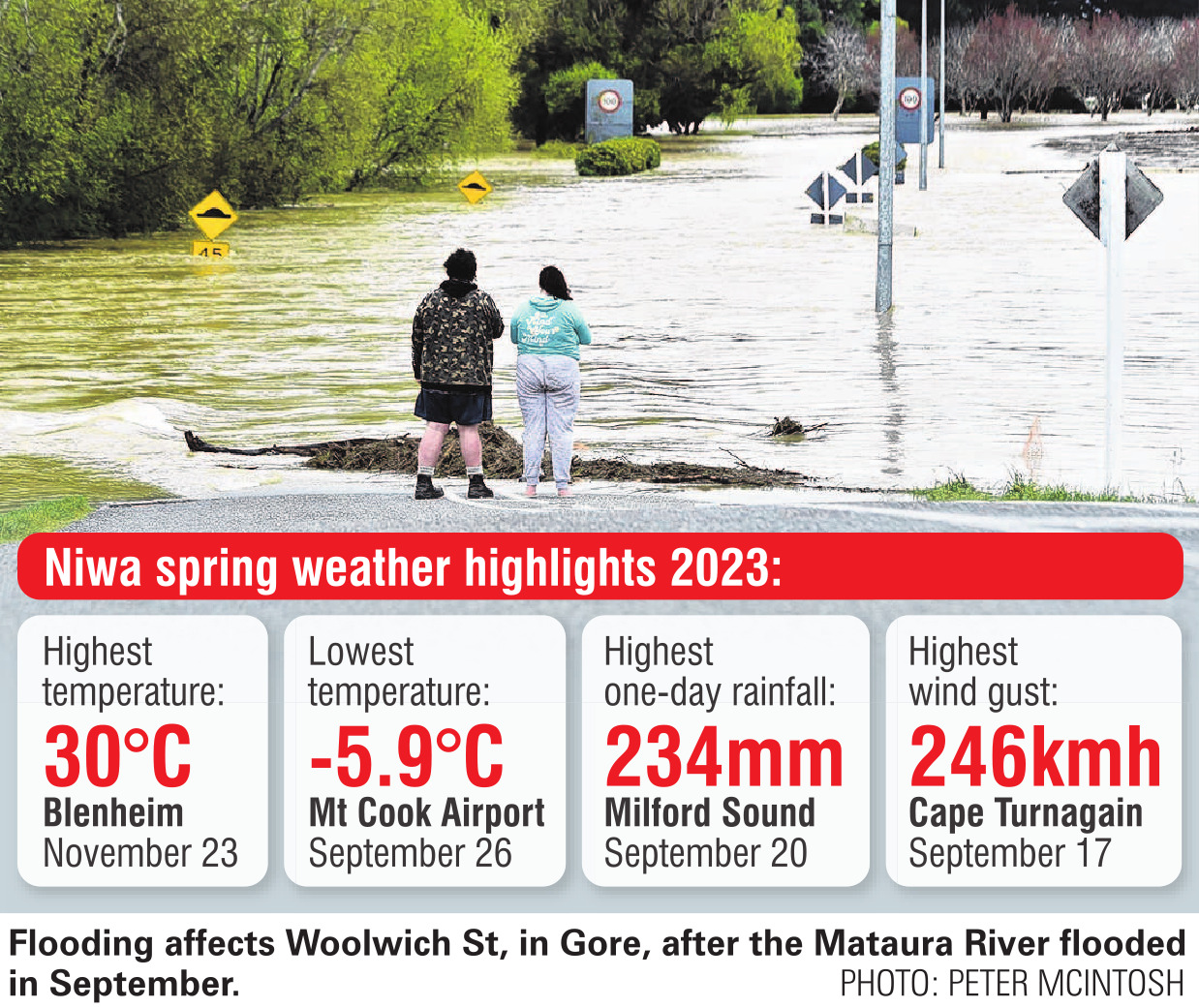
Mr Macara said the "above normal" spring rainfall recorded in inland Otago was caused by a heavy rain event on September 21-22, when parts of Southland, Otago and Canterbury flooded and a state of emergency was declared in Southland and Queenstown.
"The Gore and Mataura combined stormwater and wastewater network was reportedly overwhelmed, leading to widespread surface flooding.
"Surface flooding was also prominent in other parts of Southland, with flooded stormwater drains reported to be contaminated with sewage in Winton, Lumsden and Nightcaps.
"In Queenstown, 68 properties were evacuated due to flooding and associated debris."

On the same day, Wānaka (98mm), Queenstown (87mm), Gore (68mm) and Manapouri (63mm) recorded their second-highest one-day rainfalls, and Clyde (50mm), Green Island (31mm), Clyde (50mm) and Tautuku (49mm) recorded their third-highest.
Mr Macara said spring this year was characterised by a large area of higher-than-normal mean sea-level pressure over and surrounding New Zealand.
"This generally resulted in more northeasterly winds than normal for eastern and northern parts of the North Island, with westerly winds prevailing for the lower South Island.
"El Nino strengthened in the tropical Pacific during the season, with several strong westerly wind events signalling its building influence across New Zealand."
The nationwide average temperature for spring was 12.8°C (0.7°C above the 1991-2020 average from Niwa’s seven-station temperature series), making it New Zealand’s 10th warmest spring on record.


