The trio consists of lead author of the maps, geologist Dr Nick Mortimer, as well as Belinda Smith Lyttle and Phil Scadden.
Dr Mortimer said the release of a research paper he had written on Zealandia three years ago had earlier sparked extensive international media attention.
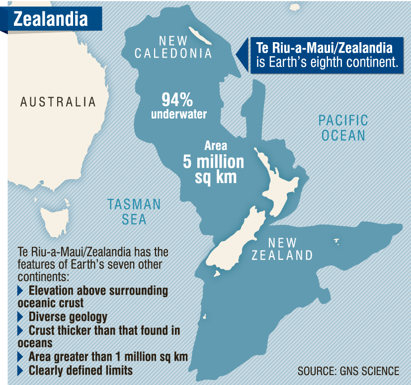
The release yesterday of two maps of the 5million sq km Te Riu-a-Maui/ Zealandia continent, and a related interactive internet site, was also likely to add to international interest in New Zealand, he said.
"We certainly hope it will do that.
"A lot of people have heard of Zealandia from three years ago and now they can explore it themselves [via computer and maps]," he said.
The two maps and an interactive internet site where they can also be explored, were released yesterday to mark World Hydrographic Day.
The Dunedin office of GNS Science had played a "large role" in the map production project, as had programme leader Dr Vaughan Stagpoole, and Dr Jenny Black, both of Lower Hutt.
Only 6% of the Zealandia continent — comprising mainly New Zealand and New Caledonia — sits above sea level.
The maps cover the bathymetry — shape of the ocean floor — and the tectonic origins of the continent on which New Zealand sits.
They can also be accessed through a new interactive website called E Tuhura-Explore Zealandia (TEZ) http://data.gns.cri.nz/tez.
The new maps provided a more "accurate, complete and up-to-date picture of the geology of the New Zealand and southwest Pacific", than ever before.
Eighty million years ago, at least 50% more of modern mainland New Zealand was above water, and Zealandia itself was much closer to Antarctica, having since moved about 5000km north to its current position, he said.