
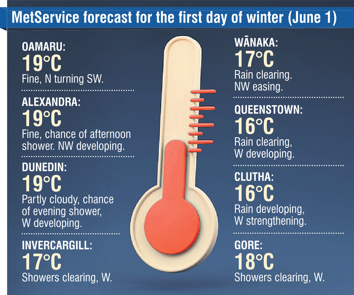
Instead of frigid and wet conditions, like those experienced during much of May, the mercury could touch 20°C in some places on Saturday.
But true to winter conditions, there may still be a shower or two, MetService meteorologist Dan Corrigan said.
"It’s that classic foehn wind set-up where northwest winds travel over the Southern Alps, bringing warmer and drier air down the eastern side of the mountains, and that’s what’s going to be cranking those temperatures up into the high teens for Otago.
"At the same time, there will be a heavy band of rain moving up the West Coast."
He said the "unusual" temperatures were expected to peak on Saturday morning, before the northwesterlies turned more southwesterly, bringing some rain.
"Friday afternoon and Saturday morning look like they’re going to be quite warm, indeed, for this time of year.
"It’s not often we get to say a summer blast is coming, rather than a polar blast, at this time of year.
"Especially given that it’s been a pretty cold May, it will feel like quite a big change."
He said normal temperatures (the low teens) would resume on Sunday, but it would be sunny for most places around the South, making for a nice weekend to be outdoors.


