
Release of the new combined southeast province data, covering both southern prospective basins, follows last year’s northwest province release, beyond Northland, with three more areas to be released by the end of next year — all part of the overall Atlas of Petroleum Prospectivity project.
The data release on New Zealand’s numerous offshore basins comes as the Labour-led Government considers quitting the annual oil and gas exploration tendering system, put in place by the previous government and run by permit agency New Zealand Petroleum & Minerals.
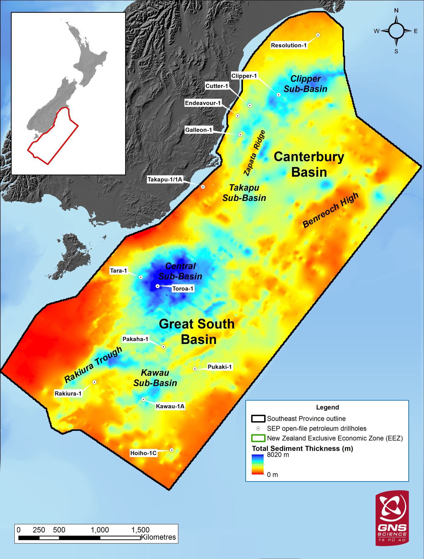
The new southeast province data covers 180,000sq km of offshore territory.
Programme leader and petroleum geologist Dr Kyle Bland said the data pack collated 40 years of existing geoscience information, plus new open-file data on test holes previously drilled, on subsurface seabed areas, where oil and gas may potentially have accumulated.
"As well as helping guide petroleum exploration in these basins, the datasets also provide important new constraints and insights into the tectonic evolution of southeast Zealandia during the last 110 million years," Dr Bland said.
He said the free, work station-ready data packs would help accelerate decision-making by providing regional-scale information on factors such as sediment thickness, and the distribution of potential source, reservoir and rocks layers, which may be trapping oil and gas deposits.
The digital atlas will be used by companies evaluating petroleum prospects globally, either new to New Zealand or already here, specialist providers to the exploration industry, and government agencies administering permit allocations.
The southeast province area is arguably one of the most scrutinised by the exploration sector at present, with the Clipper permit (top right) held by New Zealand Oil & Gas, which is talking up its prospectivity of the Barque prospect to attract big financial backers to drill a test hole. A decision is due by next April.
Lead data compiler Tusar Sahoo said the multi-level assessment would be "enormously helpful" to exploration companies which may be weighing up the merits of looking more closely at several areas.
The Atlas of Petroleum Prospectivity represented the first time such a unified approach had been applied to New Zealand’s numerous offshore basins, he said.
"The release of the northwest and southeast province data packs shows that there remain large parts of offshore New Zealand that appear to have all the elements for a working petroleum system" Mr Sahoo said.


