Council compliance and development group manager Jane Donaldson said it is referred to as a Te Araroa Iti (Te Araroa small, or bite-sized), and the report will describe the economic impact of increased numbers of walkers and the district promoting the walk.
"The report does not make a distinction on whether walkers would stay in Methven or would choose Mount Somers, Staveley or even Ashburton town."
The initial report will only gauge the potential benefits, not how it would work.
"The report will look at the economic impact of such an attraction for the district, however, it is not a feasibility report."
The short walk would focus on a section of the full Te Araroa route that runs through the district and can be done over a few days, and would have the walkers utilise local accommodation and hospitality services before and after.
"Likely two to three nights in the route, with accommodation before the walk and a final night before heading home," Donaldson said.
"We are keen to utilise other providers such as Salt or the hot pools as add-ons for visitors."
The report will cost $22,500 and is being evenly funded by the council and the Te Araroa Trust, Donaldson said.
"Te Araroa are investigating this and there is no expectation at this stage for further council funding.
"The council, through the Experience Mid Canterbury branding, would promote this visitor asset."
Te Araroa is New Zealand's long-distance tramping route, stretching around 3000 kilometres along the length of the country's two main islands from Cape Reinga to Bluff.
In Canterbury, it runs along the Southern Alps, from the Harper Pass Track in the north to the Ahuriri River in the south.
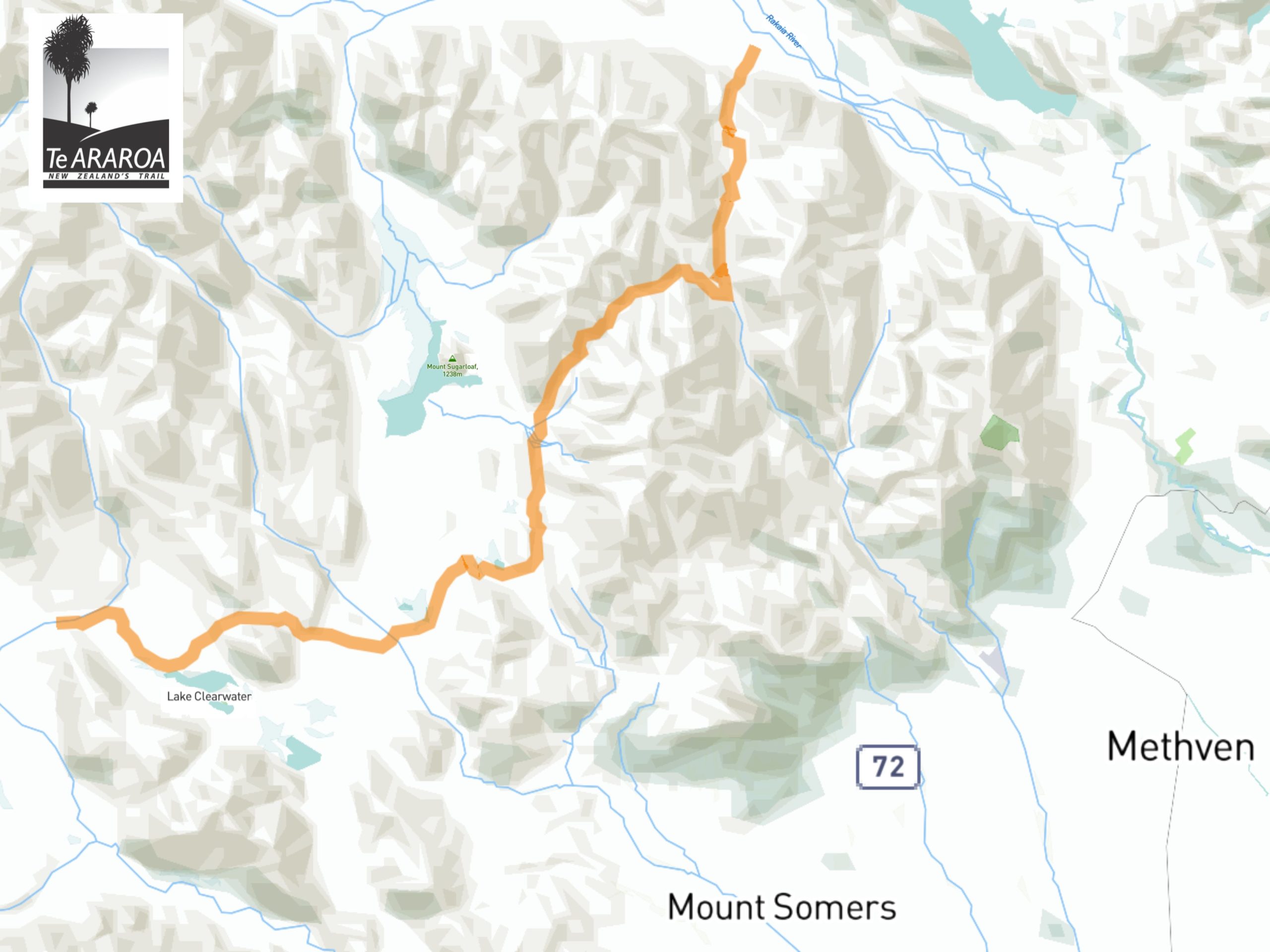
The trail gets interrupted by the natural borders of Mid Canterbury - the braided Rakaia and Rangitata rivers which require people to detour using roads to reconnect the trail at either end of the district.
The Rakaia-Rangitata is a four-day 69.7km trek between the two rivers, starting at Double Hill in the north, running along the Southern Alps and crossing through the Hakatere Conservation Park to the Ashburton Lakes where it ends at the Potts River.
By Jonathan Leask
Local Democracy Reporter
LDR is local body journalism co-funded by RNZ and NZ On Air.