Omarama in North Otago was the coldest place to be early this morning and by 9am was still on -6.5°C, according to MetService.
Other places weren't much warmer: Queenstown was on -2°C, Wānaka 1.5°C, Invercargill 0°C and Christchurch on 1°C. Dunedin and Oamaru recorded 5°C and 4°C, respectively while Stuart Island/Rakiura at the bottom of the country was a relatively warm 8°C.
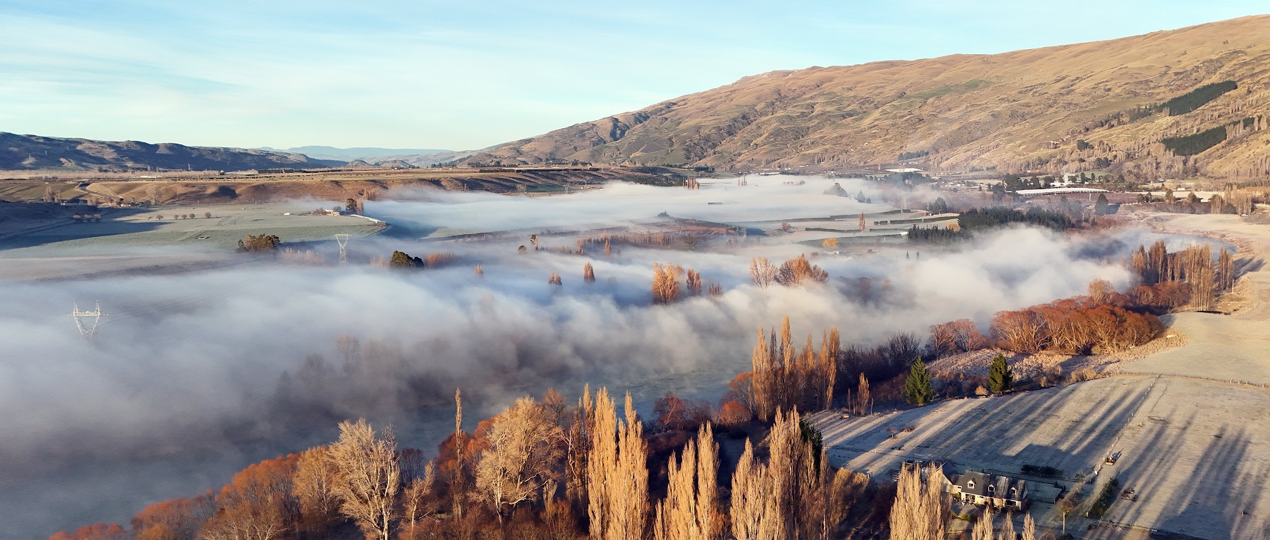
It was a frosty start again today for most of the Central Otago district, with isolated areas of thick fog around Alexandra and the Cromwell Gorge, and temperatures ranging from -6°C to 1°C.
In Queenstown Lakes, it was just as chilly as Wednesday, so road users were warned to watch for patches of ice, a spokeswoman for the district council advised.
Grit was applied to frosty sections on the Crown Range Road, linking Queenstown and Wānaka, which early this morning had an oddly warmer air temperature at the summit of 2.3°C but the road was -2.4°C, she said.
"Remember to use your lights and travel at a safe speed in foggy areas."
Extra care was needed using Glenorchy Road and in areas that aren’t seeing any sunshine so not thawing out.
"Crews have noticed a lot of driveways affected by frost, so be careful when exiting, reversing out of these areas."
Niwa says the strongest high-pressure system anywhere on the planet was now centred over New Zealand – and it is likely to strengthen further on Thursday.
The forecaster said barometers had this week registered a national mean sea level pressure record for July, reaching 1045 hectopascals (hPA).
“According to our national climate database, the national mean sea level pressure record is 1046 hPa, occurring a few times in recorded history and as recently as June 2016 in the South Island,” Niwa said.
“The high pressure system over the country is set to peak in intensity tonight and tomorrow, potentially breaking this record.”
In a high-pressure system, air descended and spread outward, typically leading to clear skies, calm conditions, and stable weather, Niwa said.
“While there is certainly a lack of precipitation, some folks may be awakening to foggy or frosty conditions.
"In parts of Central Otago like Alexandra and Clyde, a phenomenon called an inversion may cause the fog and freezing temperatures to last all day. We’ll be watching closely.”
MetService earlier said the high was forecast to drive the weather over the country for the week, heralding in clear skies, light winds and frosty nights for most.
"Low sun angle at this time of year means it can take a while for low cloud or fog to clear up, especially in shady inland valleys,” MetService meteorologist Ngaire Wotherspoon said.
It was "a great time to get outdoors for the first week of the school holidays, with bluebird skies and light winds for South Island ski fields".