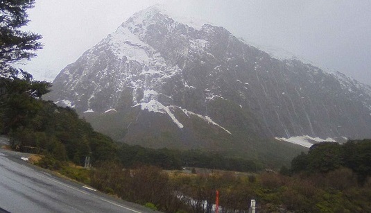
It's another week of rain, snow and disruption for Southland's Milford Road, and more wild weather is forecast for many parts of the South Island.
There are heavy rain warnings and watches, as well as severe gales forecast for Fiordland, Southland, the Otago headwaters, Canterbury and Westland until Tuesday.
A temperature drop is expected on Wednesday and Thursday - particularly in eastern areas, MetService said, with frosts possible in parts of the South Island and snow for higher passes.
State Highway 94 was closed at 5pm yesterday due to a moderate risk of avalanche and reopened at 10am today after crews assessed the area, Milford Road Alliance said.
Though the risk was downgraded to low this afternoon, the road would close again at 5pm due to "further intense weather increasing the hazard overnight".
Rain was forecast for Monday, while Tuesday would bring showers with snow down to 800 metres. Rain was also forecast for mid-week and by Friday there would be heavy falls.
The Milford Road was closed for much of last week overnight as heavy rain and snow increased the avalanche risk.

Strong winds and rain
A strong wind watch is in place for Fiordland, Southland including Stewart Island and for inland Otago from 6pm today until 5am on Tuesday. Northwest winds may approach severe gale in exposed places.
MetService said periods of heavy rain were likely for the Otago headwaters from 8pm today until 8am tomorrow.
Rainfall amounts may approach warning criteria within 15km east of the main divide and thunderstorms were possible.
The forecaster has also issued an orange strong wind warning for the Canterbury High Country from 6pm today until 8am on Tuesday. Severe northwest gales would gust up to 120km/h in exposed places.
Heavy rain was set to fall in the Canterbury headwaters, south of Arthur's Pass, from 11pm today until 11am on Tuesday. Expect 80 to 100mm of rain about the main divide, and 60 to 80mm within 15km further east. Peak rates of 10 to 25mm/h expected in thunderstorms about the divide.
In Westland, periods of heavy rain were likely from 10pm today until noon tomorrow, and amounts may approach warning criteria.
Care needed on Crown Range
There has been a fair bit of rain in the Queenstown Lakes district area and ponding was affecting many sections of road over the network today.
There had also been some minor rock falls over the Crown Range Road, linking Queenstown and Wānaka, which have been removed by roading crews, a spokesman for the district council said this morning.
"Be sure to double your following distance, use your headlights (fog lights if necessary), and if your steering feels light due to aquaplaning, ease off the accelerator and slow down gradually."
Care was also advised on the Wānaka-Cardrona road.


