Rain set to drench the South in coming days has prompted a slew of weather alerts for many areas, including Dunedin.
MetService this evening updated its severe weather advisories to include a heavy rain warning for Dunedin, North Otago and Clutha, for 24 hours from midday on Thursday.
The forecaster said to expect 80 to 110mm of rain about the ranges, and 50 to 80mm nearer the coast. Further rain was possible for Clutha and Dunedin during Friday afternoon and evening.
This comes after weather agency Niwa this afternoon warned that eastern Otago could see two months' worth of rain, leading to the possibility of flooding.
Niwa forecaster Seth Carrier said Thursday would see heavy rain affect much of the country, including southern Canterbury, eastern Otago and eastern parts of Southland.
"As we go into the afternoon, our attention shifts to the South Island, most notably far southern Canterbury, eastern Otago and eastern portions of Southland.
"As we go through the afternoon and evening, periods of moderate to briefly heavy rain affecting those portions of the South Island, and that is a concern because that area typically sees quite a bit less rainfall than other parts of the country."
In the North Island, Carrier said rainfall could exceed 100 millimetres, but in those South Island areas, rainfall of up to 100mm or 150mm was possible.
"100mm of rainfall could be more than a month's worth of rain for these areas and if we get up to 150mm, which is possible, that could be more than two months of rainfall for these areas so it certainly does increase the flooding threat for that part of the South Island as we go through Thursday and into Friday as well."
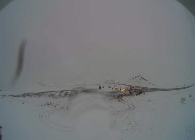
By Wednesday evening much of Otago was experiencing ongoing rainfall, and snow was falling on both the Crown Range Road and the Lindis Pass (State Highway 8). At 8pm both roads were still open, but chains were required for the Crown Range Road, the Queenstown Lakes District Council said.
Niwa yesterday said normal rainfall in Dunedin could reach 60mm in October, and earlier today said said places like Dunedin and Balclutha could see twice their normal rainfall for the month in two or three days.
The Dunedin City Council this afternoon said its contractors were out checking stormwater systems, "but they can’t be everywhere, so we need your help to clear drains from leaf litter and debris".
The council said it was keeping an eye on the situation to see if sandbags would be needed.
MetService earlier said streams and rivers might rise rapidly, and surface flooding, slips and difficult driving conditions were possible.
"Clear your drains and gutters to prepare for heavy rain. Avoid low-lying areas and drive cautiously."
Emergency Management Otago stakeholder engagement adviser Erica Andrews said the organisation would continue to keep a close eye on the situation, and advised residents to keep up to date with the latest forecasts and check their website for information.
In Clutha District, up to to 100mm of rain was expected over the next three days.
In a statement, the council said today contractors were working around the towns checking that sump tops are clear. Residents were asked, if they were able, to check the drains outside homes.
"Due to the size of the network, should there be any flooding, signage will be prioritised accordingly with regular updates sent out via Antenno, the council's website and council's Facebook page.
"It is expected that any surface flooding will be widespread so we ask that everyone takes care on the roads and avoids driving through areas of deep flooding where possible. If you come across any flooding that we recommend notifying the council via Antenno or phone (0800 801 350)."
A heavy snow watch issued for Central Otago and the Queenstown Lakes District today has been lifted. However, snow warnings were in place for some southern roads.
Alpine road snow warnings - updated 9pm
The Lindis Pass (State Highway 8): Rain was expected to turn to snow from 8pm on Wednesday until 3am on Thursday. Up to 2cm could to settle near the summit, with lesser amounts to 800 metres.
The Crown Range Road, linking Queenstown and Wānaka: For 7 hours from 8pm on Wednesday until 3am on Thursday. Light snow falling on the road and additional 1 to 2 cm could settle near the summit, with lesser amounts to 800 metres.
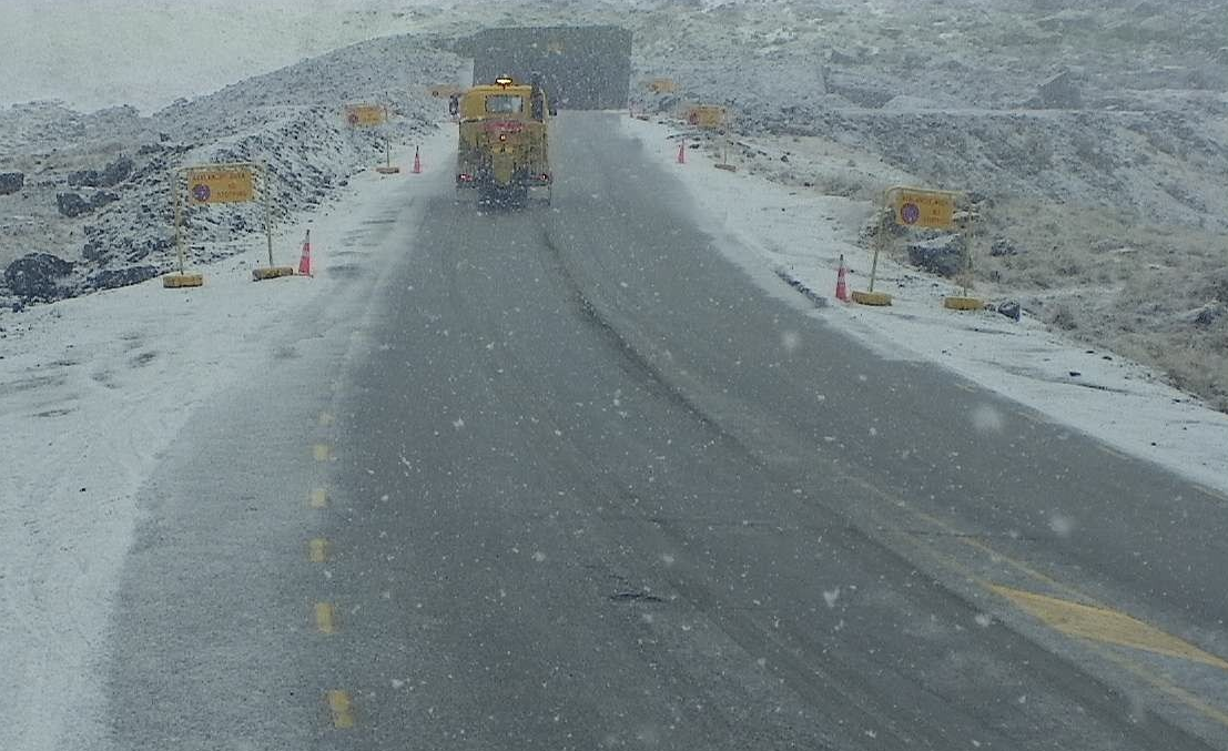
In Southland, the Milford Road (SH94) reopened on Wednesday afternoon but chains had to be carried from East Gate (Hollyford) to Donne River (Westgate) from 5pm due to snow around the Homer Tunnel from the afternoon.
MetService has issued a heavy rain watch for Southland, for 18 hours from midday on Thursday.
Milford Road Alliance said road users should expect snow clearing vehicles working throughout the afternoon and winter driving conditions. "Please drive with care."
- additional reporting ODT Online/RNZ