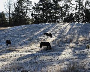
A "stunning" week will be followed by a weekend of heavy rain and severe gales as the weather system arrives to batter the country on Friday or Saturday.
It's likely to pass over Auckland on Saturday night and into Sunday morning, WeatherWatch head analyst Philip Duncan said.
While it would no longer be classified as a tropical cyclone by the time it reached New Zealand, it would still "pack a punch", he said.
"We expect it will move in around Saturday or Sunday and it could bring very heavy rain and severe gales to northern New Zealand, and across the weekend it will affect all of the North Island at some point," Mr Duncan said.
However, it is not yet known which part of the country will be worst hit by the tropical storm.
"A lot of the weather around this low will be just your normal cloudy, windy sort of stuff, it won't be severe. But the worst of the weather is the centre part where the worst of the wind will be and some of the heaviest rain will be. That's the area we're watching very closely and are yet to work out specifically where it will go," Mr Duncan said.
MetService meteorologist Dan Corbett agreed, saying it was looking like a "batten down the hatches" weekend, which could get "quite nasty in some places".
"Certainly northern New Zealand, so Northland to Auckland to the Bay of Plenty, through Saturday, it will certainly be spells of heavy rain, strong winds, gales - maybe even severe gales," he forecast.
"Then the actual centre of that low, that's still a little bit difficult to determine exactly where, but it does look like it's tracking towards northern New Zealand for late Friday into Saturday."
Both Mr Duncan and Mr Corbett said the picture of where the storm is likely to go will get clearer as the week goes on, and were hopeful that by tomorrow they would have a better idea of where the centre would strike.
Tropical Cyclone Lusi was currently a category one cyclone sitting near Vanuatu, and was "slowly intensifying in the very warm, bath-like waters" in the Pacific which fuels such storms, said Mr Corbett.
It is likely to grow into a category three cyclone within 24 hours, he said, and track to the south and west of Fiji.
By the weekend it will reach New Zealand waters, where the cooler temperatures will have the effect of "someone pulling the plug".
"It will be weakening as it comes towards us, but it will have already become quite strong," Mr Corbett said.
- Patrice Dougan of APNZ


