Contractors will be working hard to restore access to closed roads progressively from tomorrow morning as flood waters recede and snow is cleared, NZTA Transport Systems Manager Mark Pinner said
“We’re asking drivers to avoid stopping on snow-affected roads, and to be aware that ice may begin to form as snow melts in the early hours of Sunday.
"Potholes may also start to appear due to the saturated ground, there are likely to be fallen trees, slips and other debris on the road surface.
“Our crews will be working hard to clear roads and restore access as soon as possible, but we need drivers to do their part by slowing down and take extra care when driving on South Island highways for the rest of the long weekend."
In Otago and Southland SH6 Haast to Makarora is closed due to flooding and SH94 Milford Road is closed due to snow.
Multiple roads are closed in Canterbury, the West Coast and Marlborough.

However, further bad weather is forecast for Sunday and more snow is forecast.
MetService has issued a heavy rain watch for eastern parts of North Otago and Dunedin from 9pm on Saturday until 5am on Sunday.
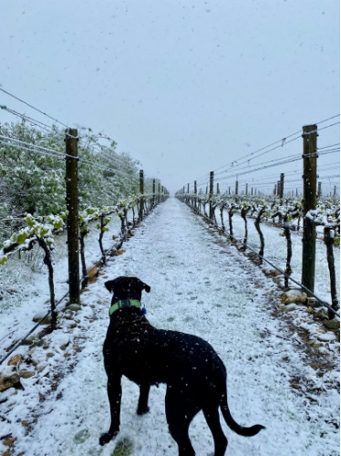
Snow settles in Central Otago
Snow settled in Central Otago this morning as an unseasonable cold front moved over much of the southern South Island today.
Otago Regional Council staff have been activated and will be on duty over Labour Weekend, monitoring streams, rivers and lake levels across the region and updating relevant councils about any forecast flooding concerns.
Expectations of heavy rainfall and the possibility of "unseasonable snow" to lower levels across Otago today has prompted the ORC to reiterate MetService’s call to be prepared.
ORC science and resilience general manager Tom Dyer said a weather front heading north up the West Coast was expected to loop over the Southern Alps and come back down into Central Otago, North Otago and possibly coastal areas, from noon today through to a peak about midnight tonight.
"While the weather has been relatively benign around most of Otago for the past few days, heavy rain is expected, which could cause ponding or minor surface flooding in some areas.
"There is also unseasonal snow forecast to above 600m inland, but there’s potential it could lower to around 400m or less in some areas."
A MetService heavy snow warning was in place until 9pm Saturday for the Queenstown Lakes District and Central Otago.
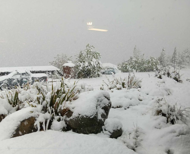
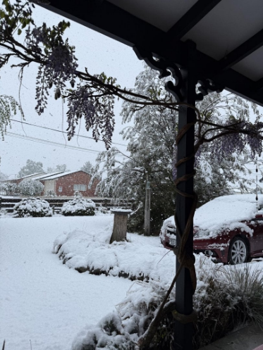
As much as 20-40cm of snow is expected to fall above 600m, with lesser amounts down to 400m. Considerably more snow is expected to fall at higher elevations. In addition, rain is forecast to be heavy at times below the snow level.Alexandra was looking wintery this morning as snow fell and began to settle on the ground.
Sergeant Darren Kidd, of Alexandra, said there had not yet been any problems due to the weather.Snow was settling in a lot of areas and driving behaviour was reported as good.
Rain in Otago today is expected to total 30mm-50mm, falling "steadily" at about 5mm per hour.
Mr Dyer said that itself was unlikely to trigger alerts, but the still sodden ground from the flooding on October 3-6 in coastal Otago and some areas inland was the concern.
While most southern rivers had already peaked during the past 36 hours from the first front, the second front today could again see rivers and streams rise, which could pose dangers for people looking to ford waterways.
He suggested the rural sector should be considering plans to potentially move stock from low lying areas, and how they could be fed.
He urged anyone with concerns to visit ORC’s Environment Data Portal on the front page of ORC’s website for up-to-date tracking of river levels.
MetService forecast in North Otago and Dunedin was for heavy rain at times for the 15 hours from 9am today to midnight, and there was a likelihood the situation would be upgraded to a warning.
Road closures and restrictions
Tasman
SH60 Takaka - between Pupu Valley Road and Waitapu Wharf Road – closed due to flooding No Detour
SH6/SH65 Murchison – Closed and will remain closed overnight due to slips and flooding
Marlborough
SH6 Pelorus Bridge to Havelock – Closed due to flooding – high tide due 8pm
SH63 Renwick to between Brydon St and Angelsea St Closed due to flooding – local detour
SH63 St Arnaud – near Kowhai Point Camping Area – flooding across both lanes
There are a number of local road closures on the Marlborough District Council network including Queen Charlotte Sound due to flooding/slips.
West Coast
SH6 Inangahua (Upper Buller Gorge), between intersection SH69 and Brown Creek Road – flooding, local detour in place.
SH6 Lower Buller Gorge - Closed due to flooding.
SH7 Stillwater to Dobson – Stillwater Underpass – Closed due to flooding.
SH65 Closed at Springs Junction
SH73 Arthurs Pass – Closed due to snow
Canterbury
SH73 Porters Pass – Closed Due to snow
SH7 Springs Junction – closed from midday Sunday to 3pm for vehicle recovery (subject to SH73 reopening)
SH80 Lake Pukaki to Mt Cook – Closed due to snow
Otago/Southland
SH6 Haast to Makarora – Closed due to flooding
SH94 Milford Road – Closed due to snow


