High country farmers testing nitrates on their properties have found the finger pointing mostly at them for lowering water quality at Mid Canterbury’s Ashburton lakes is unfair.
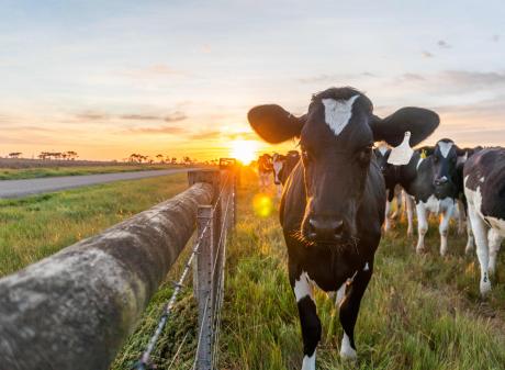
The five families at Castle Ridge, Erewhon, Hakatere, Lake Heron and Mt Arrowsmith stations are taking water samples for nitrates and other nutrients in streams and creeks passing through their properties before they enter the lake and wetland network.
They have identified the highest nitrates in the upper reaches of spring-fed creeks and found water quality in other creeks often improves after passing through farmland.
This runs contrary to reports showing the main nutrient source across all lakes was from pastoral land use with minor sources including potential seepage of human wastewater at Lake Clearwater and Lake Camp and waterfowl waste at Lake Emma, Lake Denny and Lake Emily.
Castle Ridge Station co-owner Kerry Harmer said there had been a long-standing discussion about the standard of water quality at Ashburton lakes.
She said the farming families had been working a long time to work out how much of an influence farming had on water quality.
Tests were carried out from the top of streams going through farm properties, midway and as close to the point where they met lakes, she said.
"The results have been quite interesting and in about 60% of those test results over different properties the water gets better," she told 50-plus farmers and industry people attending a Federated Farmers High Country field day. "It starts off at the highest level of nitrates at the top of the creek and then by the time it’s dropping out and into the lake it’s actually significantly lower. A portion are sitting about the same all the way through and then only two or three are the other way and those are the ones that all have spring fed water going into them."
She said springs at higher elevations had the highest nitrate readings.
The source of this groundwater was unknown and more science was needed to know how long it took to come through the soil profile or what distance it was moving across valley floors, she said.
A funding proposal was with the Ministry for Primary Industries to look at demonstrating some mitigation options. In the meantime they were working with the Ōtūwharekai Working Group involving the main government and local government agencies, local iwi and other conservation and recreation groups towards a catchment action plan for the area.
"At the moment all the heat is on us as the landowners, but actually we are only part of this and only part of the problem and only part of the solution. So we want to build the science with everybody as part of that and find out exactly what is going on. Up until now the finger has been pointed at us as the sole cause of it all and we are already working out that actually we are not."

Some of the larger lakes had other pollution problems and others such as Lakes Emma and Emily were shallow, often stirred up by wind and had a lot of geese and other birds on them.
Nitrate levels ranged from less than 0.002g/m3 to the highest of 1.4g/m3 at springs when it was dry and it would be difficult for farm changes to make a difference to the lower amounts, she said.
She said they took the nitrate tester to a zone committee meeting and the result of a sample from a creek near her house was 10-fold lower than water in a jug on the table.
Mrs Harmer said the lakes were not meeting Environment Canterbury’s (Ecan) land and water regional plan targets and while the focus was on nitrates, clearly there were other inputs contributing to lake quality.
Erewhon Station owner Colin Drummond said rotting vegetation in the shallower lakes and surrounding red tussock shut up from grazing for a long time must be affecting the water quality.
"What’s that got to do with farming?"
Hakatere Station co-owner Donald Whyte said they were among the first to be deemed to be in a sensitive lake zone and other farmers should know that rules were coming their way too.
"We’ve been pretty much the first cab off the rank in this area for Mid Canterbury and have continued to be a focus. We had to get a consent to farm and basically we were regulated to [do this]. Three of the properties here went ahead and got those consents to farm and in my case that took us just on two years and just north of $36,000 if I didn’t charge myself for anything. That was a five-year consent and has been now pulled basically — the consent conditions are in review."
He said it was frustrating being made to "jump all the time".
Mr Whyte said they were lucky they did not have the direct influence of other farmers as a lot of the lakes areas and margins were fenced out in buffer zones when his father freeholded Mt Possession from university owners in an early tenure review.
A good example was Lake Emma was taken out of full grazing influence 26 years ago yet it was still deteriorating, he said.
"So the immediacy of pressure coming on us to change our farming systems is not going to fix the lake’s deterioration. There is a lag in there and some big things happening that no-one understands, but we have got a bit of a political reaction to get rid of those bloody farmers which I think is a bit tough."
He said they had always maintained water fowl had a factor in lake nutrient levels and part of the testing looking at E. coli backed this up.

"At the moment — and it is very much still under negotiation — but there is a suggestion in our draft consent conditions to have sheep excluded from sensitive areas as well as cattle and deer."
That would impact 90% of their sheep area at Castle Ridge if it ever went ahead. To fence all their waterways would cost more than $1 million and sourcing stock water would be a problem, she said.
"Somehow we have to get through to regulators the pendulum needs to swing to common sense or else the result is none of us will be able to farm sheep the extensive way we do up here."
In reply to a query by Ecan councillor David East, the farmers said they would willingly share their data to authorities.
Mrs Harmer said much of the computer modelling used to calculate nutrient loads was not based on climate records for the area with some of the science based on research from dairy farms on flat country instead of the high country environment.
An Ecan spokeswoman said the regional council fully recognised the limits of tools such as Overseer when looking at environmental impacts, as was pointed out in the government’s review in 2021.
"When assessing consents, we take many things into account, such as site-specific environmental monitoring and data, in person assessments, and expert opinion. Every context is unique, and we are careful to take a case-by-case approach when assessing the impact of individual farms on the receiving environment. We work with farmers to put in place robust but practical consent conditions that relate specifically to their farm and activity."
She said consents were assessed against the relevant sections of the RMA, the Canterbury Land and Water Regional Plan, and national directives.
They also considered the capacity of the receiving environment – in this case the lakes and farms within the catchment.
Ecan’s land and water plan was established before the latest national regulations and provides the framework for managing the effects on environments around the region.
Ecan runs several programmes that monitor water quality in the lakes basin. Among them are long-term monitoring across eight lakes monthly from December to April, as well as monthly on-lake monitoring and continuous water quality monitoring at Lake Heron and Lake Clearwater and monitoring groundwater in the Māori Lakes catchment.
DOC also monitors 12 streams monthly.