
From severe frosts in the south to severe gales and rain in the north, no one in New Zealand seems to be spared from the wet and wild of winter.
In the South Island, severe frosts were forecast inland, with temperatures dropping to between -5degC and -12degC.
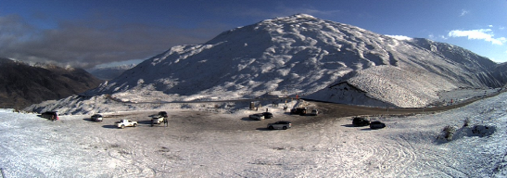
MetService says snow showers will affect the Crown Range Road, linking Queenstown and Wanaka, and state highways the Milford Road in Southland and the Lindis Pass in Canterbury tomorrow.
Crown Range Road: From 3pm-7pm expect 1 or 2cm of snow to settle on the road above 700 metres during this time.
Milford Road (SH94): From 2pm-7pm rain is expected to turn to snow near the tunnel for a time tomorrow afternoon through to early evening. Expect 1 or 2cm of snow to settle on the road near the tunnel.
Lindis Pass (SH8): From 4pm-8pm expect 1 or 2cm of snow to settle on the road above 700 metres during this time.
By Wednesday, developing northwesterlies would bring heavy rain for Fiordland, which could move north up the west coast during Thursday.
A second ridge is expected to move on the South Island from the Tasman Sea on Thursday.
NORTH ISLAND
In the North Island, a high pressure is expanding across the country, WeatherWatch says, and the upper North Island has low pressure moving in with a windy "squash zone" of air pressure creating gales, especially in coastal parts of the north and north east.
Tomorrow would be the main day for windy weather in the North Island, particularly eastern Northland and northern Auckland along the eastern coastline.
The gusty winds and gales will then move on later in the day to East Cape, Gisborne and eastern Bay of Plenty.
MetService forecaster Aidan Pyselman said Gisborne and other areas of North Island should expect rain tomorrow and Tuesday.
- NZ Herald and ODT Online


