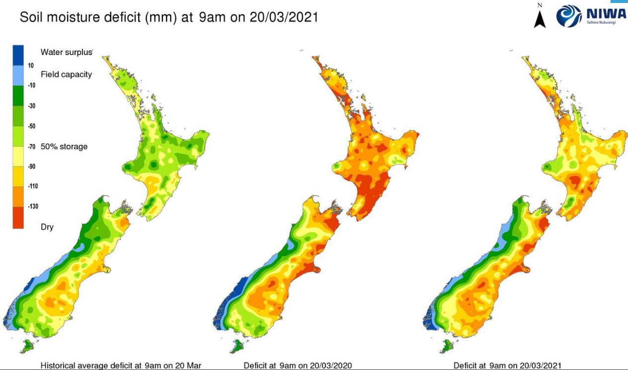
Weeks of settled weather has left vast swathes of New Zealand parched - and the driest pockets are expected to worsen amid another warm, fine week ahead.
Niwa's latest monitoring report showed hot spots - those places with severely to extremely drier than normal soil conditions - had now formed in many parts of the country.
They included parts of Canterbury, Northland, Auckland, Waikato and the East Cape, the stretch from Hawke's Bay to Wairarapa, Wellington city, much of eastern Marlborough, and coastal Otago south of Dunedin.
And the latest New Zealand Drought Index map pointed to widespread "dry to very dry" conditions across most of the central and eastern North Island, along with northeastern South Island and parts of Otago and Southland.Fire danger was currently running high in northern spots like Whangārei, Dargaville, Kaipara and Woodhill, along with large parts of Marlborough, central Canterbury and northern Otago.
Recent rainfall had been meagre - most places in the North Island received less than 10mm last week, thanks to a dominant high pressure system - and little better was expected next week.
MetService was forecasting less than 2mm of rain across most of New Zealand for the next six days.
Niwa forecaster Ben Noll said some places, like eastern Bay of Plenty and the East Cape, were now seeing a rainfall deficit of around 50mm.
"That's the kind of number that is probably going to require maybe two or three good rain-makers to get these soils back closer to normal."
While there were few of these expected in the short-term, Noll said April could deliver some relief.
"We might have not one, but potentially two pulses of the Madden-Julian Oscillation (MJO) coming across the Australasia region - one in the first 10 days of the month and the other in the last 10 days."

"So that might give us a couple of opportunities for some decent rainfall over April. In any case, the month definitely has more potential for rain than we've seen lately."
Noll said New Zealand's post-summer dry could be partly explained by the fact that weather-influencing "forcing patterns" in the tropical atmosphere had been centred in the Indian Ocean, thousands of kilometres away, rather than in the central Pacific.
"As this pulse tracks closer to us, at the end of March and into April, we might expect to see things change in our neck of the woods," he said.
"But what we're seeing now is really part of the overall pattern that's been with us over the course of the summer season."
What had been the main background weather driver - a "non-traditional" La Nina climate system - was fast fading and would likely be gone completely by mid-year.


