It comes after Prime Minister Chris Hipkins last month instructed the transport agency to narrow its speed management review to focus only on the 1 per cent of state highways with the highest numbers of deaths and injuries, and where local communities supported change.
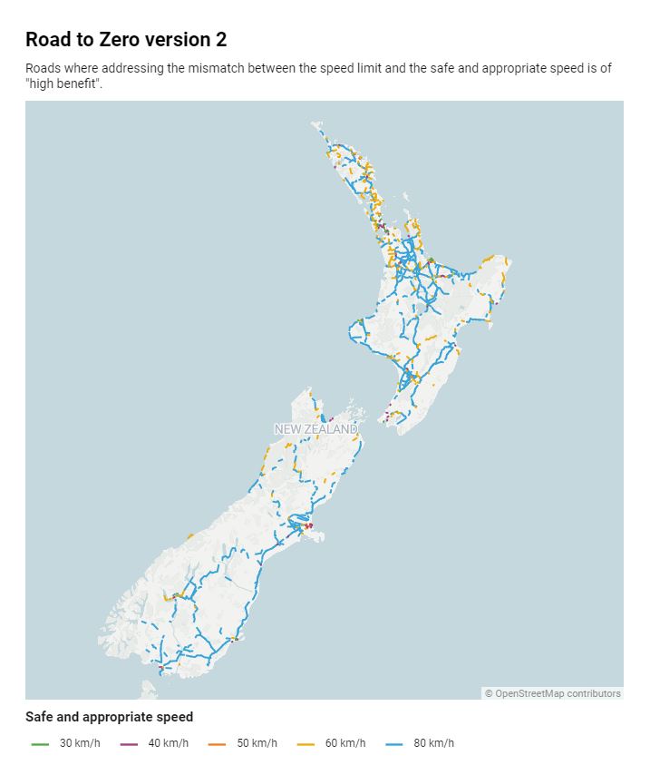
Waka Kotahi identified the new 2,566km of roads where the speed limit was too fast for the state of the roads on its internal geospatial database, Megamaps, this week.
It includes 683km of Auckland roads.
MegaMaps is understood to be a tool Waka Kotahi uses for its own research and planning.
The agency has earlier marked 7,465km across New Zealand where the speed limit is higher than what it calls "safe and appropriate".
This equates to more than 85 per cent of the country’s roads.
It says reducing the speed limits or improving the state of these roads would be a big help in reducing the road toll.
In an interim plan released last year, it proposed first targeting 3.2 per cent of the state highway network with reduced speeds and safety improvements.
However, last month Hipkins significantly narrowed the scope of the national speed reduction plan as part of a dramatic revision of the Labour Government’s policies heading into the next election.
Roading safety improvements, such as median barriers and rumble strips, would also still go ahead as priorities, he said.
There would also be targeted reductions in the areas immediately around schools, marae and in small townships that a state highway runs through.
Dylan Thomsen, the Automobile Association’s speed policy spokesman, said the new information about Waka Kotahi’s internal map tool and the Prime Minister’s decision to narrow the focus had created uncertainty.

But when and where that 1 per cent of roads would be identified was unknown, Thomsen said.
He said current legislation requires every council around the country to produce a plan by next year that outlines any speed reductions they intend to make over the next three years.
"Are we still going to see those plans being produced and going ahead after the Prime Minister’s new direction," Thomsen said.
"We’re not sure right now, it’s very uncertain."
AA has been asking for clearer directions on what the way forward for speed reviews would be, he said.
He said if the new direction to narrow the focus of speed reductions meant greater priority would now be given to looking at upgrading and better engineering dangerous sections of road "that would be fantastic".
A Waka Kotahi spokesperson said local authorities used MegaMaps for their own reviews and the data would continue to be available for them.
The interim plan was also being reviewed to reflect Cabinet’s scaling back on proposed speed limit reductions and these changes were anticipated in the coming month.
The next full plan, which the Herald understood would have included far more extensive road safety and speed limit changes, is in development.
"We are also reviewing this plan to align with the new focus for speed management on state highway corridors," the Waka Kotahi spokesperson said.
"Much of the ‘Full State Highway Speed Management Plan’ was already intended to be focused on schools, marae, townships and areas where there is clear public demand for speed changes."
Last year, 377 people died on the road, higher than the most recent pre-pandemic year – 2019 – when 350 were killed in road crashes.


