A cold front is now expected to bring "significant snow" to low levels in the south of the South Island overnight and into tomorrow.
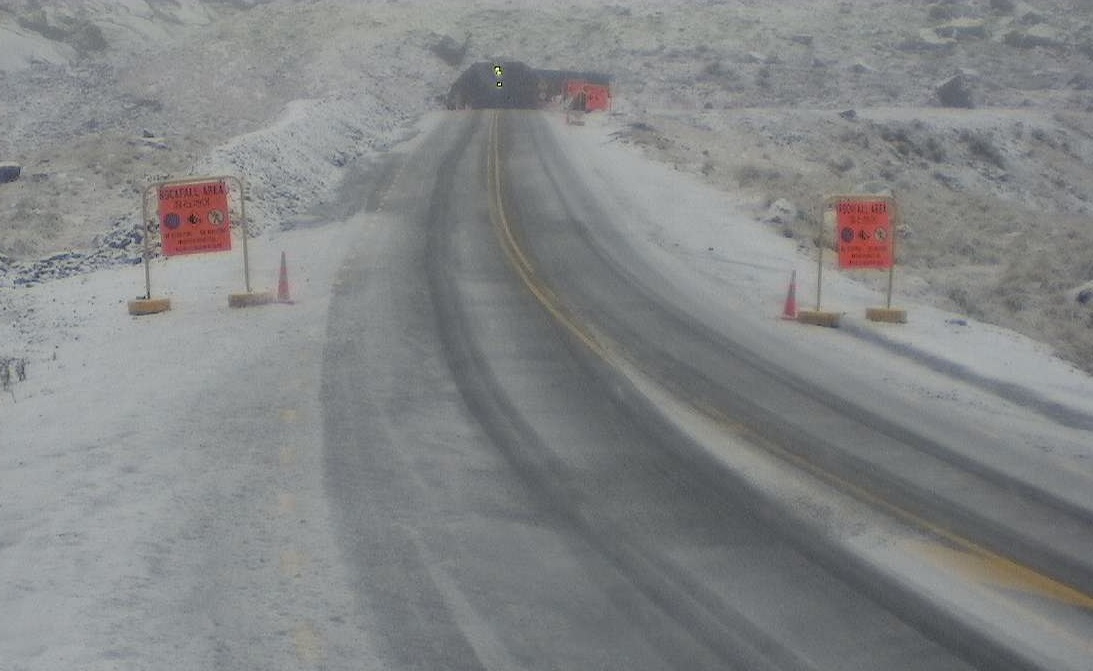
The Milford Road on State Highway 94 in Southland is to close from East Gate (Hollyford) to West Gate (Chasm) from 4.30pm today due to heavy snow forecast overnight.
"Significant snow is also expected throughout Tuesday with the road not expected to reopen," NZ Transport Agency Milford Road advised.

There is also a Strong Wind Watch in place for Coastal Southland, Clutha and Dunedin, where there could be southwest gales from 10am-9pm on Tuesday.
The forecaster had earlier advised that Dunedin's hill suburbs were included in its forecast for snow tomorrow morning.
Until yesterday, Dunedin had not been not expected to get snow like the rest of Otago and Southland.
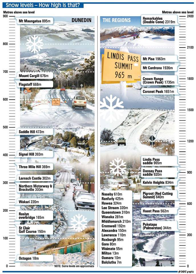
However, meteorologist Ashlee Parkes said the updated forecast now showed snow showers would fall to 300m around Dunedin.
In the most recent update, at 1.45pm on Monday, MetService said Fiordland could receive 15cm to 20cm of snow from 300m and above, as well as snow flurries down to 200 metres.
A snow watch is in place for Southland, Clutha and Central Otago, where it may be heavy at times and approach warning criteria above 300m from 2am until 6pm on Tuesday.
There could also be at least a dusting for many elevated areas in the South Island. These include all alpine passes and the Crown Range Road (linking Queenstown and Wanaka).
Road users should check with the NZTA to see how these passes are affected as they could shut quickly.

"It’s going to be quite cold first thing, but it should warm up later in the day as the winds ease."
Fellow meteorologist Kyle Lee said if snow did fall down to 300m inland, it would affect a lot of roads around the region, especially the higher routes.
"I expect it to cause some form of delays and affect a few higher roads, specifically in the Central Otago region.
"But at this stage it’s hard to pinpoint which regions or exactly which roads we think will be affected."
He advised farmers to keep an eye on the forecast to see how it developed, because they might need to move stock to more sheltered areas.
"If they can, they should be prepared to act accordingly to whatever advice is given."
On Thursday, a ridge of high pressure was expected to move on to the country from the Tasman Sea.
Road snow warnings
Haast Pass (State Highway 6) - Between 2am and 9am Tuesday, 1 to 3cm of snow may settle near the summit of the road, with lesser amounts to 400 metres.
Lindis Pass (SH8) - Between 4am and 10am on Tuesday, 2 to 3cm of snow may settle on the top of the road, with lesser amounts to 400 metres.
Lewis Pass (SH7) - Between 5am until 4pm on Tuesday, 5 to 10cm of snow may accumulate near the summit of the road, and lesser amounts to 600 metres.
Arthur's Pass (SH73) - Between 3am to 4pm Tuesday, 5 to 10cm of snow may accumulate near the top of the road, with lesser amounts to 600 metres.
Porters Pass (SH73) Between 4am and 11am Tuesday, 1 to 3cm of snow may settle near the top of the road, with lesser amounts to 600 metres.
Crown Range Road - From 8pm today to 10am toorrow, 5 to 10cm of snow may settle near the summit, with lesser amounts to 400 metres.
Milford Road (SH94) - From 7pm today to 5pm tomorrow, 20 to 30cm of snow may settle near the tunnel, with lesser amounts to 300 metres. The road will close on Monday from 4.30pm and may not open on Tuesday.


