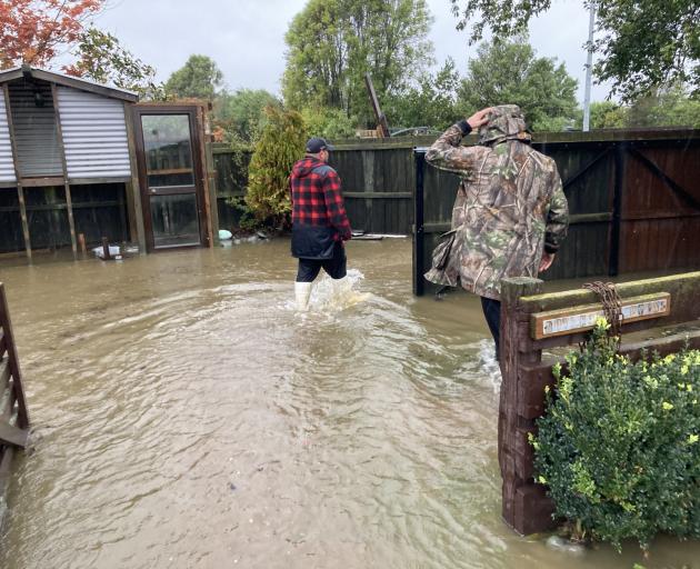
Selwyn District has declared a state of emergency and asked residents of Selwyn Huts to evacuate as rivers continue to rise and rain lashes already sodden ground.
Some were in denial about the effects of climate change on the community, but recent weather drives home the reality, Morrison said.
"It's as bad as I've ever seen it. The roads are the worst I've seen it," he said.
"But around the houses it's all ponding, so it's as bad as it gets.
"It's a long story, but we're planning for climate change adaptation and eventually over the next few decades needing to relocate, so this is just another prompt - that's how I see it. It might actually help the community to realise it's real because a lot of people are still in denial about it."
MetService has heavy rain warning and watches in place on Thursday for Gisborne, the Eastern Bay of Plenty, Kaikōura, and Canterbury including Christchurch and Banks Peninsula.

"It's just been incessant. It started last week and that made everything waterlogged and then when the new rain came then it all started flowing over. There's nowhere else to go anymore because we are not far above the sea level, so everything's totally waterlogged.
"Just incessant rain and just heaps of it."
Late last night, the Coes Ford and other fords across the district were closed due to river levels.
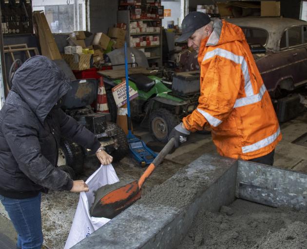
The council has distributed sandbags to some houses in West Melton, Doyleston and Leeston, and community sandbag stations have been set up at community centres in Sheffield and Glentunnel.

Canterbury schools closed
Across Canterbury a number of schools are closed and in the Selwyn District only one of the four high schools is open, Rolleston College, though it urged whānau to travel only if it is safe to do so.
Darfield, Ellesmere and Lincoln High Schools are all closed due to concerns about road safety, or surface flooding on school grounds.
Selwyn's Tai Tapu School is also closed as is Ashburton College in Mid-Canterbury.
Ashburton flooding
To the south in the Ashburton District, several roads near Methven are closed after being flooded by Dry Creek.
The council reported that there are no current concerns for bridges over State Highway 1, but NZ Transport Agency is monitoring the situation.
Environment Canterbury flood advisory suggests the main impact of the heavy rainfall remains north of the Rakaia.
The Ashburton District Council road crews are out checking on the state of the network and asking people to take care with widespread surface flooding across the district.

“Some potholes are 300 mm deep so people may see temporary speed limits and crews busily filling them as best they can do.”
The full extent of damage to the roading network across Canterbury won’t be known until the rain stops and surface water recedes.
By David Hill and Jonathan Leask
- LDR is local body journalism co-funded by RNZ and NZ On Air.