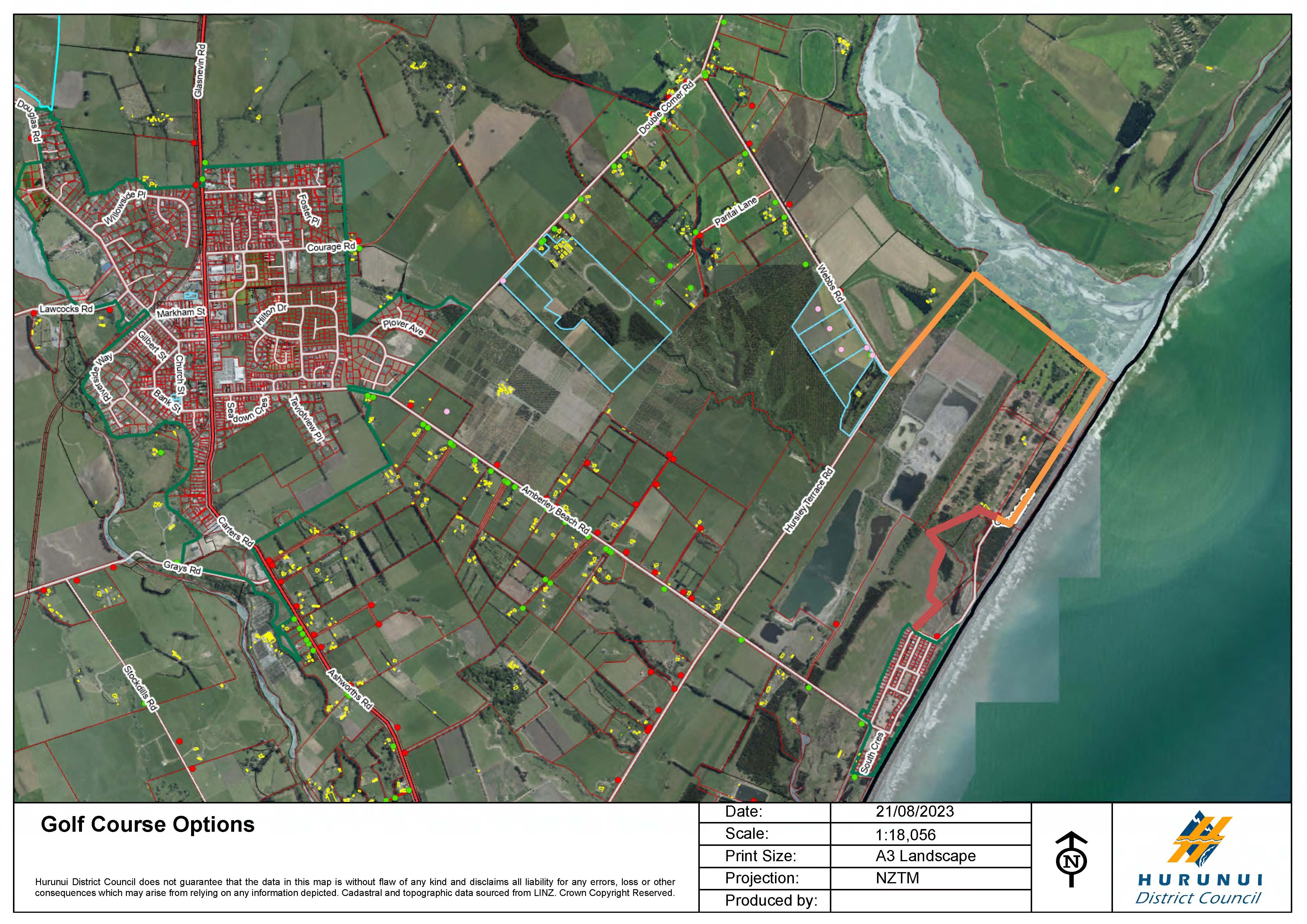
Around 50 golfers attended a Hurunui District Council meeting in August 2023, calling on the council to extend Griersons Ave to secure access to the Amberley Beach Golf Club’s clubhouse.
The golf course is under threat from coastal erosion, along with access to mahinga kai areas in the Waimaiaia Reserve and the Waipara River mouth.
The council agreed to investigate extending Griersons Ave through the narrowest part of a wetland, against the advice in a report to the August meeting written by chief executive Hamish Dobbie.
He proposed linking Webbs and Hursley Terrace Rds with Golf Links Rd from the northern end, which would secure access to the golf course but not the clubhouse.
Council staff have been working with Environment Canterbury to consider what consenting options are available.
‘‘Some progress is being made, but it is slow,’’ he said.
‘‘We are working towards an understanding with Environment Canterbury on consenting issues for a realignment of the golf course.’’
Both options would secure access to the golf course for the next 30 years.
Environment Canterbury consents planning manager Aurora Grant confirmed pre-consent application discussions were continuing.
Amberley Beach is one of several North Canterbury beach communities facing threats from erosion, coastal flooding and sea level rise.
No solution is in sight for Motunau Beach residents facing the threat of erosion.
The council has been working with two property owners at Motunau Beach, with homes perched precariously close to the cliff edge.

A geotech report was completed last year and discussions are continue to ensure lives are not being put at risk, he said.
Efforts to restore a coastal road north of Cheviot, which was claimed by the sea last year, are progressing.
The council agreed to a KiwiRail plan in August to co-fund the rebuild of Claverley Road in the Hundalees, north of the Conway River.
Mr Dobbie said council staff had further conversations with KiwiRail last week about the reinforcement of the road.
The project is expected to cost up to $520,000 and will restore access to three households, which have been relying on four-wheel-drive access.
The road also provides access to archaeological sites of importance to local Mana Whenua, while the rail network is also under threat from erosion.
Nape Nape Road at Blythe River, south of the Hurunui River, has been subject to slips following heavy rain events and coastal erosion over the last five years.
Councillors called on staff in September to prepare a strategy to provide guidance on how to respond to these situations.
It is expected to be considered as part of the Long Term Plan process in the coming weeks.
The council has also been working on coastal adaptation plans with five beach communities over the last four years.
Three plans have been adopted for Amberley Beach, Leithfield Beach and Motunau Beach.
By David Hill, Local Democracy Reporter
■ LDR is local body journalism co-funded by RNZ and NZ On Air.


