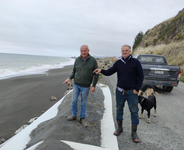
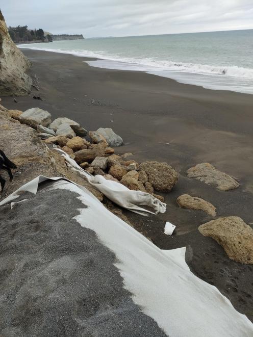
Road access has since been restored to three households, but erosion protection works along the coastline are incomplete.
The council said the work is due to be completed next month, but it cannot come soon enough for farmer Andrew 'Snips' Prentice.
‘‘The road is used a lot because of the Māori sites and there are tourist buses, fishing and motorhomes coming up here, and along the beach are fossils, so it is quite a busy road,’’ he said.
The road provides access to archaeological sites of significance to Ngāti Kurī, while the powerlines connecting Kaikōura pass through the farm.
Erosion is nothing new and the coastline dropped 400mm in the 7.8 magnitude earthquake in 2016, making the road even more vulnerable, Mr Prentice said.
He suggested in the long term a new road will need to be built over the hill.
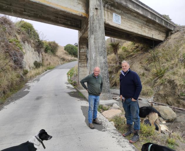
Concrete was laid to restore the road under the railway bridge a few years ago, because the sea was washing over the road and wrecked the old seal.
But the concrete road is 40mm too high, meaning the stock truck is unable to get to the farm, Mr Prentice said.
‘‘I have to run my lambs down to my neighbour’s property to get them on the truck, but that’s not really sustainable because of the concerns around worms,’’ he said.
‘‘I can see it washing away my future, because of the road and we can’t get stock out.’’
Deputy Mayor Vince Daly said he was frustrated at the slow progress of erosion works.
‘‘I just worry we will get a big swell and we will lose the whole road.’’
Hurunui District Council chief operations officer Dan Harris said the council was on track to be complete the work in May.
The project was expected to cost up to $520,000, with the council sharing the costs with KiwiRail.
Early discussions have begun for a road realignment, Mr Harris said.
‘‘This may see the road go over the hill, but there are other landowners affected by that, a QE2 covenant area and archaeological sites to consider, as well as the tricky topography.’’
A QE2 covenant is an agreement between a landowner and the Queen Elizabeth II National Trust to protect a conservation area.
Mr Harris said the stock truck access issues were due to the increased size of the trucks.
‘‘The length is a factor because the road dips under the underpass, but the longer vehicles straddle the dip, thus sitting higher.
‘‘The last correspondence we had with the property owner was that, as the only beneficiary, they were to propose a solution at their cost.’’
- Mr Prentice’s father bought a 400 hectare soldier’s block in 1950 and the farm has since been expanded to 1100ha, farming 5000 stock units of sheep and beef.
The farm border’s Rocky Peak, the former farm of Victoria Cross and bar winner Charles Upham.
‘‘When my father bought this farm, the road was surveyed to go all the way to Kaikōura, but then they decided to build the other main road (now State Highway 1).’’
By David Hill, Local Democracy Reporter
■ LDR is local body journalism co-funded by RNZ and NZ On Air.