

Stock banks contain the flooded Oreti River at Wallacetown.

The flooded Oreti River at Wallacetown.

A fire engine crosses a section of the closed Invercargill Riverton highway near Wallacetown.
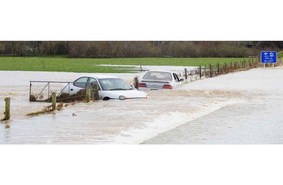
Two people were rescued overnight after trying, and failing, to drive their cars through this flooded section of the Thornbury-Grove Bush Rd at Thornbury.

Flood waters cover paddocks and bailage beside the Otautau-Riverton road where the Aparima River floods.

A section of the closed Invercargill Riverton highway near Wallacetown.

Flood waters near Wallacetown

Flooded paddocks near Wallacetown

Flooded paddocks near Wallacetown

Flood waters near Wallacetown.

Flood waters block the Otautau-Riverton road where the Aparima River floods.
Photos by Craig Baxter.