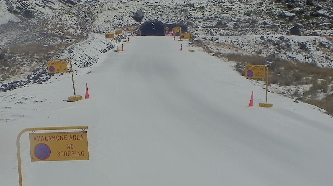
The Milford Road in Southland and Crown Range Rd has closed due to heavy rain and snow.
A front was expected to bring snow and severe gales to the South from Monday and heavy rain to other areas as a storm tracks by the country for the first half of the week.
The NZ Transport Agency advised at 9am today that the Milford Road (State Highway 94) was closed from East Gate (Hollyford Rd Junction) to West Gate (Chasm) and would remain so overnight due to an increased avalanche risk.

MetService said a few fronts would affect New Zealand during much of this week. Heavy snow was also possible about higher parts of the South Island.
"During Tuesday, snow was expected to affect higher inland parts of Otago and Canterbury, and there is now low confidence of snow reaching warning amounts from the Queenstown Lakes District to the Mackenzie District. It is, however, considered likely that large amounts of snow will affect areas above 1000 metres."
SNOW FOR ALPINE PASSES
Snow is set to affect nearly all the alpine and high roads in the South Island including the Crown Range, linking Queenstown and Wanaka, until Wednesday, MetService advised today.
CROWN RANGE ROAD
From 6pm on Monday until 10am on Tuesday: Snow is expected to develop above 900 metres this evening and continue until Tuesday morning. 2cm to 4cm of snow may accumulate near the summit, with lesser amounts down to 900 metres.
MILFORD ROAD (SH94)
From 12pm on Monday until 6pm on Tuesday: A few snow flurries are expected near the tunnel during the day, with more substantial snow developing above 700 metres on Monday evening and continuing until Tuesday evening. About 15cm to 30cm of snow may accumulate near the summit during this time, with lesser amounts down to 700 metres.
LINDIS PASS (SH8)
From 9pm on Monday until 12pm on Tuesday: Snow is likely to develop above 900 metres this evening and continue until around midday tomorrow. 1cm to 3cm of snow may accumulate near the summit.
LEWIS PASS (SH7)
From 5am on Tuesday until 10am on Wednesday: The snow level is expected to lower to 700 metres during Tuesday morning. Periods of snow are likely until Wednesday morning. During this time, 2cm to 5cm of snow may accumulate near the summit with lesser amounts down to 700 metres.
HAAST PASS (SH6)
From 8am until 4pm on Tuesday: Snow flurries are possible near the summit of the road during Tuesday morning and afternoon. Little, if any, snow is likely to settle on the road.
ARTHUR'S PASS (SH73)
From 1pm on Tuesday until 8am on Wednesday: Periods of snow above 800 metres are likely from Tuesday afternoon until Wednesday morning. 1cm to 2cm of snow may accumulate near the summit.
HEAVY RAIN
A heavy rain warning has been issued for Buller, Nelson west of Motueka and the Nelson Lakes from 9pm today until early Wednesday morning.
On the West Coast, heavy rain fall would turn to snow at higher elevations over Monday and Tuesday.
Up to 120mm of rain was expected to fall in Fiordland from 9am on Monday until 6am on Tuesday. Thunderstorms were likely.
A heavy rain warning was in place for the headwaters of Otago lakes and rivers from 1pm-11pm on Monday, MetService said.
Expect 90-110mm main divide, and 60 to 90mm within 15km east of the divide. Peak intensities of 10 to 20mm per hour near the main divide, especially in thunderstorms.
STRONG WINDS
Strong wind watches or warnings were in place for most of the South Island - including all of Otago, Southland and Stewart Island - until Monday night.
Winds are forecast to be severe in exposed places, with gusts reaching 120km/h.
Strong winds forecast for the Canterbury High Country, while a strong wind watch is in place for Christchurch.
A strong wind watch has also been issued for the Chatham Islands with severe winds likely from 6pm on Tuesday until 2am on Wednesday.
Strong wind gusts could damage trees, powerlines and unsecured structures. Driving may be hazardous, especially for high-sided vehicles and motorcycles.
- ODT Online


