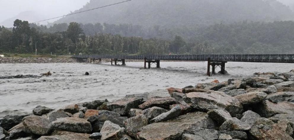
A briefing released by MetService under the Official Information Act outlined how the state-owned enterprise was busy issuing severe weather warnings and advice during the three-day event but also had to deal with "competing narratives" from Niwa.
Niwa also provided over-inflated rainfall forecasts for Otago and Southland at the same time, the paper said.
The risks to life and public safety from alternative commentaries during extreme weather, when MetService is the Crown agency designated with issuing warnings, was one of the catalysts for last year’s Project Hau Nuku review of the weather forecasting system.
From that, the government has decided Niwa should acquire MetService, as long as regulatory and legal issues are worked out.
In a confidential briefing for the Hau Nuku review team from Sapere about the West Coast’s extreme rain event from April 9-11, MetService said its forecasters were extremely busy dealing with the complex weather event, the largest one of the year to that point.
"The event prompted a significant surge in MetService severe-weather forecasting activity and extensive engagement with affected councils and associated multi-agency CDEM [civil defence emergency management] groups."
While the highest, "red" level, warning was considered for the rainfalls which subsequently reached up to 400mm along the Coast and double that or more in the ranges, the decision to stay at the orange level was made collaboratively with the West Coast CDEM group.
"Staying at orange was the appropriate call.
"The quality of the collaborative management of the event reflects lessons learned during the major events of 2023 and strengthening operational relationships between MetService and councils," the briefing said.
An analysis of the warnings issued for many parts of the country showed they were accurate, with just one false alarm (for the Coromandel) when rain did meet thresholds, and no missed warnings.
However, Niwa was "active on social media and through their interactive channels, providing detailed forecast information, including specific forecasts of rainfall amounts".
"To our knowledge, Niwa did not mention, or promote, warnings issued by MetService.
"This illustrates a common occurrence, with Niwa contributing substantially to the public narrative during major weather events without connecting with, or supporting, the official warning service.
"This appears to reflect Niwa’s competitive stance."
Of "particular concern" was incorrect advice from Niwa to the Ministry of Transport’s multi-agency transport response team (TRT), which acts for the transport sector under CDEM regulations, the briefing said.
"Niwa delivered a comprehensive weather briefing to the TRT on April 9 that included detailed forecast information that was significantly different to MetService’s forecasts and warnings."

— Rainfall predictions for Westland that were significantly higher than MetService’s warnings.
— A forecast of "very dry" conditions for the area west of Motueka through April 12, despite a MetService severe weather watch later upgraded to a warning for heavy rain.
— Rainfall forecasts for Otago and Southland (both inland and near the coast) that were far in excess of MetService forecasts and warnings.
"MetService staff were able to alert the Ministry of Transport quickly and ensure the TRT group was provided with the correct forecasts and warnings.
"However, this highlights the potential for confusion among government agencies responding to a crisis event.
"The competing narrative from Niwa, which had the potential to undermine the warning system, was unhelpful and a good example of unproductive competition," the briefing said.
Also released under the OIA was a letter from MetService chief executive Stephen Hunt to his Niwa counterpart, John Morgan, on June 23 last year, outlining three occasions on which Niwa commentary jarred with MetService’s official warnings for heavy rain and strong winds.
On two of these — May 19 and May 29, 2023 — "Niwa commentators appeared on national media and discussed the current weather forecasts in detail".
"Each time, they failed to mention the official severe weather watches and warnings which were in force, and instead presented Niwa’s alternative views".
On June 23, 2023, with a MetService "red" warning issued for Gisborne, where a local state of emergency and evacuations were taking place, and an orange warning out for Hawke’s Bay, Niwa produced a "conflicting and confusing communication", Mr Hunt’s letter said.
That was in the form of a post on X, with a map showing the only place with a "high chance" of 100mm or more of rain was in the Ruahine Range southwest of Waiouru.
Niwa also used the same colours as MetService’s red and orange warnings, and yellow watches, on the map to delineate high chance, medium chance and low chance.
Mr Hunt said it remained MetService’s view that conflicting warnings "in particular from other government organisations, can lead to confusion and erosion in public safety when severe weather presents a risk to life and infrastructure".
"Again, I ask your Niwa Weather spokespeople to use the official severe-weather watch and warning information that MetService provides during warning-level events, and to play their part in consistent public-safety messaging," his letter said.
Asked for comment on these cases, a Niwa spokeswoman said: "We are aware of MetService’s perspectives."
— Paul Gorman


